Hi,
I have Yellow lines with values ( attribute Value ) and i need to assign value to quotes ( red lines ), respecting the interval Value+1:
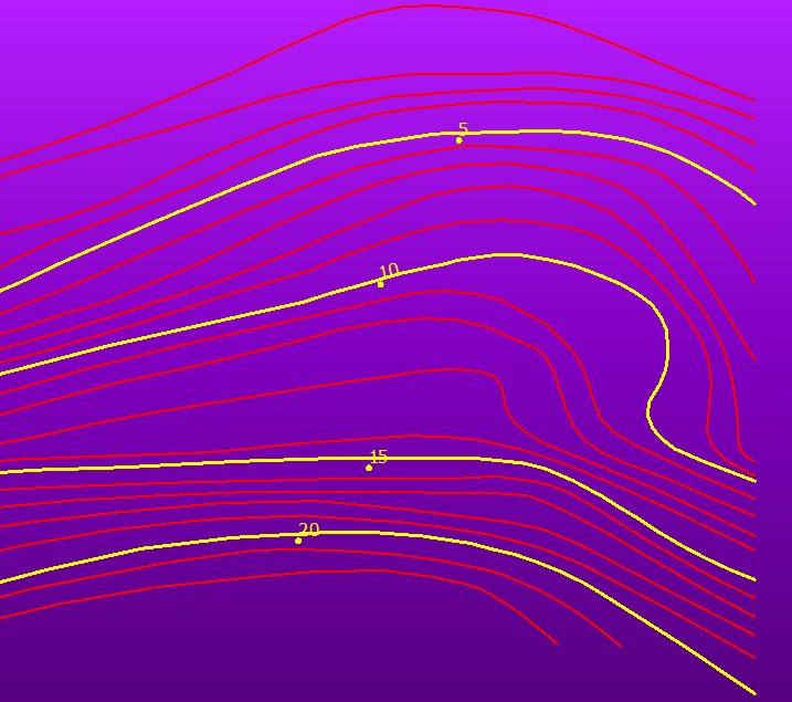
My situation:
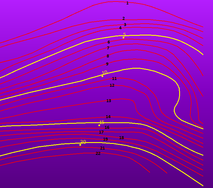
What i want ( black numbers ):
Attached my files.
Thanks, -
Danilo


 +45
+45Hi,
I have Yellow lines with values ( attribute Value ) and i need to assign value to quotes ( red lines ), respecting the interval Value+1:
My situation:
What i want ( black numbers ):
Attached my files.
Thanks, -
Danilo
Best answer by jdh
I have two wildly different suggestions.
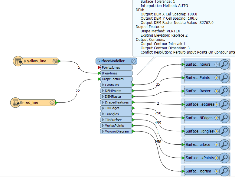
1. Generate a surface model from just the known contours (yellow) and drape the unknown contours (red) on the surface, get the average Z value for the contour and round to the nearest interger.
2. Use some combinations of the LeftRightSpatialCalculator and NeighborFinder. Thought is that for each known contour you check whether the nearest known contour on the Left is increasing or decreasing. Then the nearest unknown contour on the left side will be +/-1 and the opposite on the right. Wash, rinse, repeat.
Enter your E-mail address. We'll send you an e-mail with instructions to reset your password.