I am pretty new to FME and I am trying to find a way to transform contour lines that have been clipped into polygons where the boundary of the Clipper polygon would be used to close the polygons.
The point is that I am trying to create polygons to illustrate the flooding zones which elevation are:
2 years: between 0 and 21.99
20 years: between 21.99 and 22.75
100 years between 22.75 and 23.2
Any hint is welcome !
Thank you,
Best answer by redgeographics
I've had a go at it:
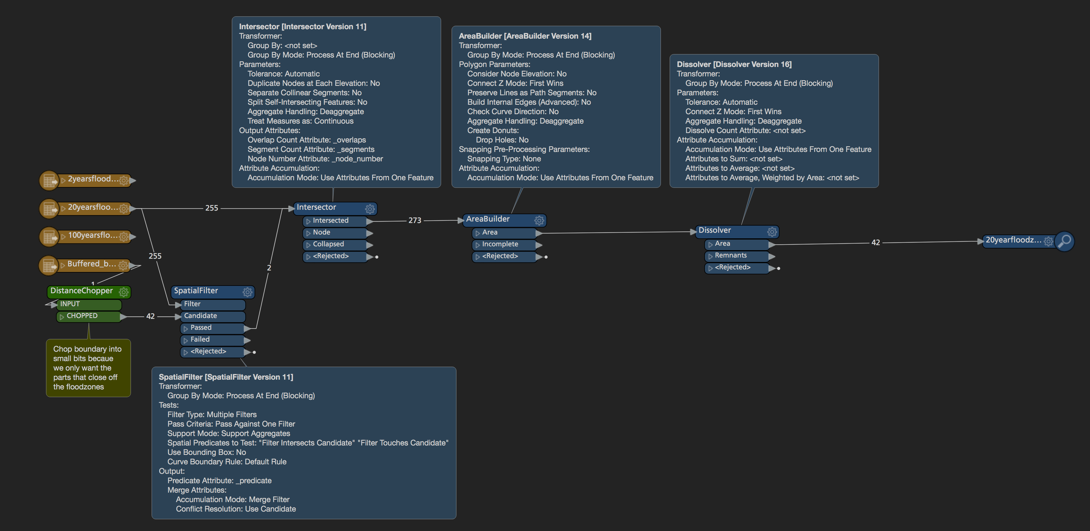
It looks like this works for the 20 years flood zone, but not for the 100 years one as there is some weird stuff going on at the western end of it. I'm sure that can be fixed with FME but I'm a bit short on time today.
The key is to cut up the buffered boundary into smaller segments and use only the ones touching the contour lines to form areas, this avoids forming the big polygons on either side of your set of contours. You'll need to either repeat this set of transformers for the other 2 inputs or make 2 additional copies of the buffers, assign them attributes matching the input names and setting group by's on the transformers.
The transformer to convert lines to polygons is the AreaBuilder.
The link is a link to the documentation of that transformer.
Sorry, I think I need more details about how to do what I am trying to do... all the polygons that I am creating with AreaBuilder are not what I am looking for...
Any tutorial to use AreaBuilder ? all I can find is about making polygons from a grid... not my case...
It looks like this works for the 20 years flood zone, but not for the 100 years one as there is some weird stuff going on at the western end of it. I'm sure that can be fixed with FME but I'm a bit short on time today.
The key is to cut up the buffered boundary into smaller segments and use only the ones touching the contour lines to form areas, this avoids forming the big polygons on either side of your set of contours. You'll need to either repeat this set of transformers for the other 2 inputs or make 2 additional copies of the buffers, assign them attributes matching the input names and setting group by's on the transformers.
@redgeographics, so many thanks !!
It is exactly the kind of solution I was looking for !!
We use 3 different kinds of cookies. You can choose which cookies you want to accept. We need basic cookies to make this site work, therefore these are the minimum you can select. Learn more about our cookies.