Hi fellow experts and users,
I apologize if this has been asked already but I have not been able to find the topic.
I have only been using FME for a month and struggling to figure out how to manipulate data within FME. I've watched and followed exercises about using FME to reading in map data but it is confusing and overwhelming at the same time.
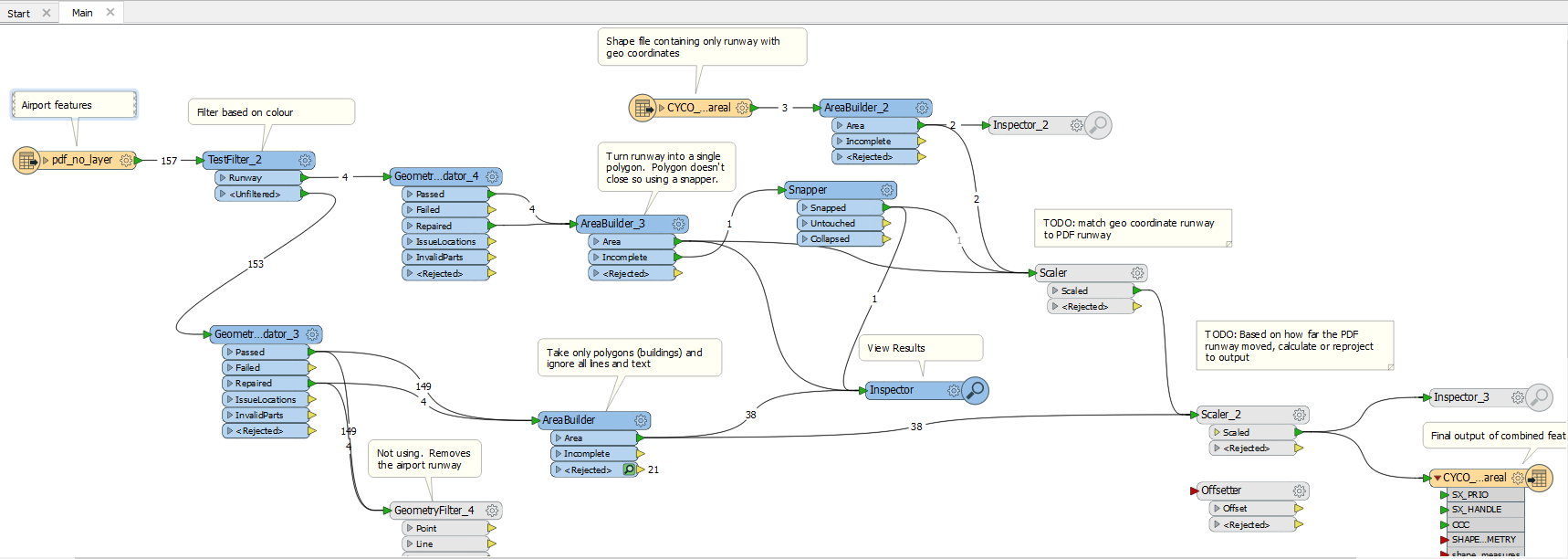
Basically I'm trying to convert a PDF representing buildings and runway and convert those points into georeferenced positions. As an input I have a georeferenced shp file containing a runway with the intention of being able to match the runways together and then being able to figure out where the PDF buildings need to be placed.
The scale of the PDF runway and the shp runway may not be the same but I was thinking it may be possible to compare each point of the polygon one at a time to figure out the distance and create some kind of scaling. I coloured the runway in the PDF as a purple line so that I have the PDF runway polygon and the shp runway polygon to correlate. Once the relative position between those points is establisehd, I was hoping the scaler transformer would be able to move the other polygons to the correct location
While it looks like a dogs breakfast, I included a screenshot of the workspace showing the approach I have taken as well as identified where the correlation needs to take place.
I'm a software developer and have not used visual coding before so I'm likely not following any best practices. Any tips or suggestions would be greatly appreciated.
Thanks,
justaguy (wanting to learn FME)


