
I am hoping for some help with comparing two different years of lidar.
I converted the area of interest to geotiffs.
I want to compare elevation. Bare earth / mud elevation.
I want to know the difference in elevation.


 +22
+22I am hoping for some help with comparing two different years of lidar.
I converted the area of interest to geotiffs.
I want to compare elevation. Bare earth / mud elevation.
I want to know the difference in elevation.
Best answer by fmelizard
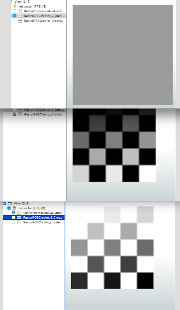
The RasterExpressionEvaluator transformer can be used for this purpose. You will need to ensure that your datasets use the exact same extents. This can be accomplished using a combination of the BoundingBoxReplacer and the Clipper transformers. Here is an example that shows the procedure for a numeric (single band) dataset.
----
No account yet? Create an account
Enter your E-mail address. We'll send you an e-mail with instructions to reset your password.