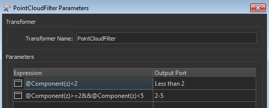
Hi everyone, I'd like to divide (extract) my point cloud data (LAS, forest) by elevation of points, e.g. one dataset would be points from 0-2 meters, 2-5, 5-10, etc., please share a good and simple tool in FME, thanks in advance!


Reply
Rich Text Editor, editor1
Editor toolbars
Press ALT 0 for help
Helpful Members This Week


Enter your E-mail address. We'll send you an e-mail with instructions to reset your password.