Question

Attempting to duplicate ARCGIS Make Route Event Layer


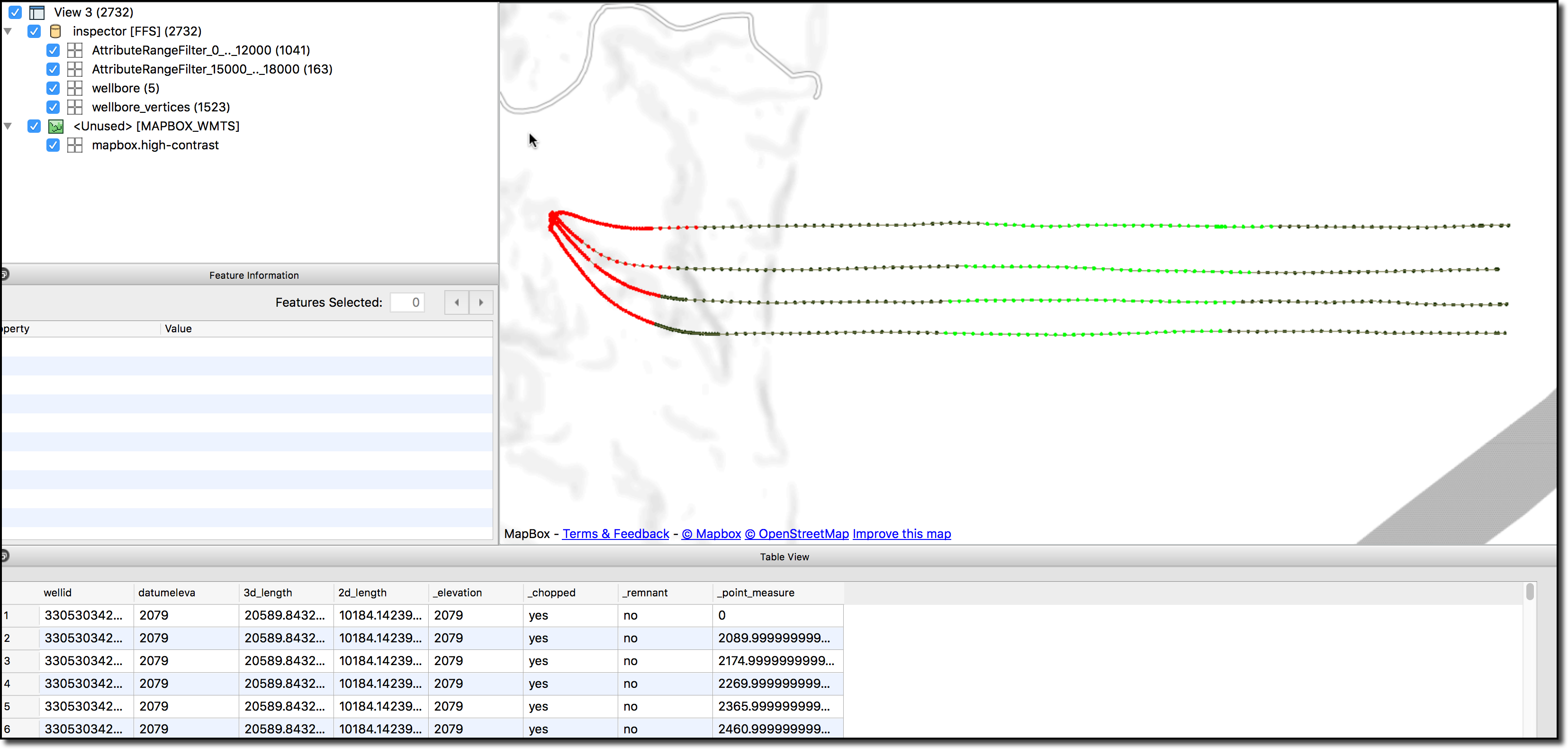
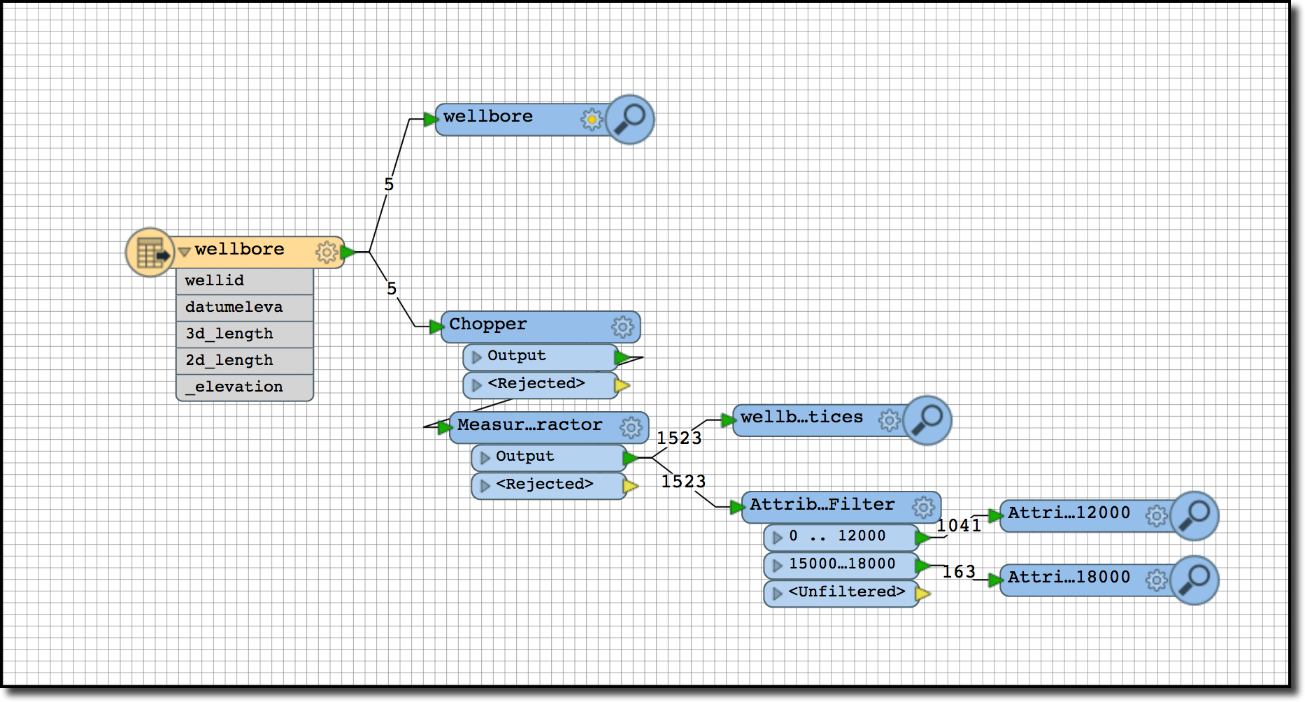
  • Within FME I have a PolylineZM shapefile with about ~12,000 different routes on it.
  • These routes are wells, they straight down into the ground and then go horizontally.
  • From within ARCGIS I can see that the PolylineZM shapefile coordinates already have Z values as well as measures associated with it.
  • In that polyline shapefile I have an attribute column with called depth that has a distance value which represents the 3D distance along the line.
  • I am wanting in FME to create a point shapefile that overlays the line at that given depth.

Does anybody have an approach that they think would work to accomplish this?

Thanks

2 replies

Forum|alt.badge.img

If I understand you correctly, you want to extract the vertices that match a separate table or file (ie intermediate casing, completion zones, etc.)

So from your 3D wellbores, I would do the following to simulate extracting the vertices (ie directional survey points) from the wellbore into a new file.

  • Chopper


    • Mode: By Vertex
    • Max Vertices: 1
  • MeasureExtractor
    • Type: Individual Vertex by Index
    • Dest Att: _point_measure
    • Index: 0
  • Next step can be done one of a few ways.
    • You can hardcode it in with an Attribute Range Filter or
    • Programmatically extract the vertices with a TestFilter and the values from your text file as it can do ranges as well.
    • If you need to extract the same vertex multiple times you will need to create a custom transformer and loop the output back to the start. Also you will want a counter so itdoesn't loop infinitely.
    • I can explain in more detail if this approach is what you are looking for.

In this example I've added an AttributeRangeFilter for _point_measure 0 - 10000 to simulate casing from the surface to the heal and colored in RED.

Also I filtered on 15000 to 18000 to simulate a completion zone or other section of interest in GREEN.

If you want a line or linear feature instead of vertices simply add a PointConnector with a GroupBy clause.

Matt...


mark2atsafe
Safer
Forum|alt.badge.img+48

A quick solution (although I may not fully understand the problem) use a BoundsExtractor to find the minimum Z value, then use a 3DForcer setting the value to the minimum Z. That way you're flattening out the feature into a line at the correct depth. Then - to get points - use a Chopper transformer.


Reply


Cookie policy

We use cookies to enhance and personalize your experience. If you accept you agree to our full cookie policy. Learn more about our cookies.

 
Cookie settings