I have a multitude of ring buffers and polygons for which I need to figure out what polygon intersects with what buffer. The task should be easy, but I am stuck here.
All data come from the same feature dataset in a file geodatabase (so the spatial reference system is by default the same), however, to be absolutely sure I projected all data before they get into the SpatialFilter to the same EPSG.
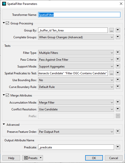
The settings for the SpatialFilter can be seen here
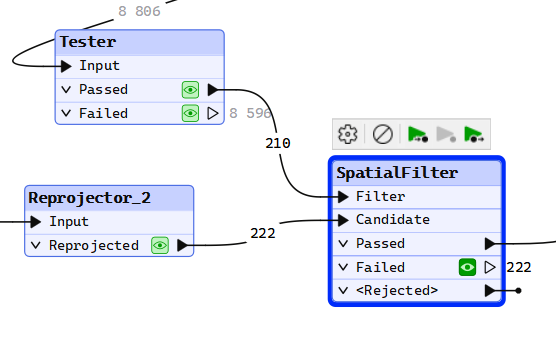
and to show that there are certainly intersecting areas and buffers that contain candidates I add the graphics view of the ‘Passed’ port and from the ‘Reprojected’ port of the Tester and the Reprojector.
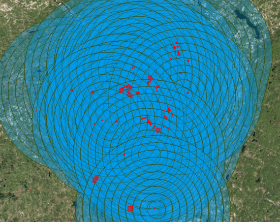
The candidates are in red…
I did try an AreaOnAreaOverlayer, and that one finds overlaps but the request of merging the attribute data is unsuccessful. Meaning all the attributes are in the attribute table, but values from the buffers are not merged to the intersecting polygons, or the other way around.
The list I create to check for what buffers the polygon intersects with is created, but when the list is not visible in the feature information view, and when I try to feed the list to a ListExploder the translation fails.
An Intersector also finds intersecting areas, creates the list, but does not add the attributes to the list as my settings implied. Instead of _buffer_id and TEN_Area I am only getting _direction in the list. The merging of attributes doesn’t work here either.
I tested the geometries and I only have polygons and donuts. Validating them reveals a few features that are not compliant to OGC, but it doesn’t matter if I continue with the features that passed the validator, the result is the same.