")

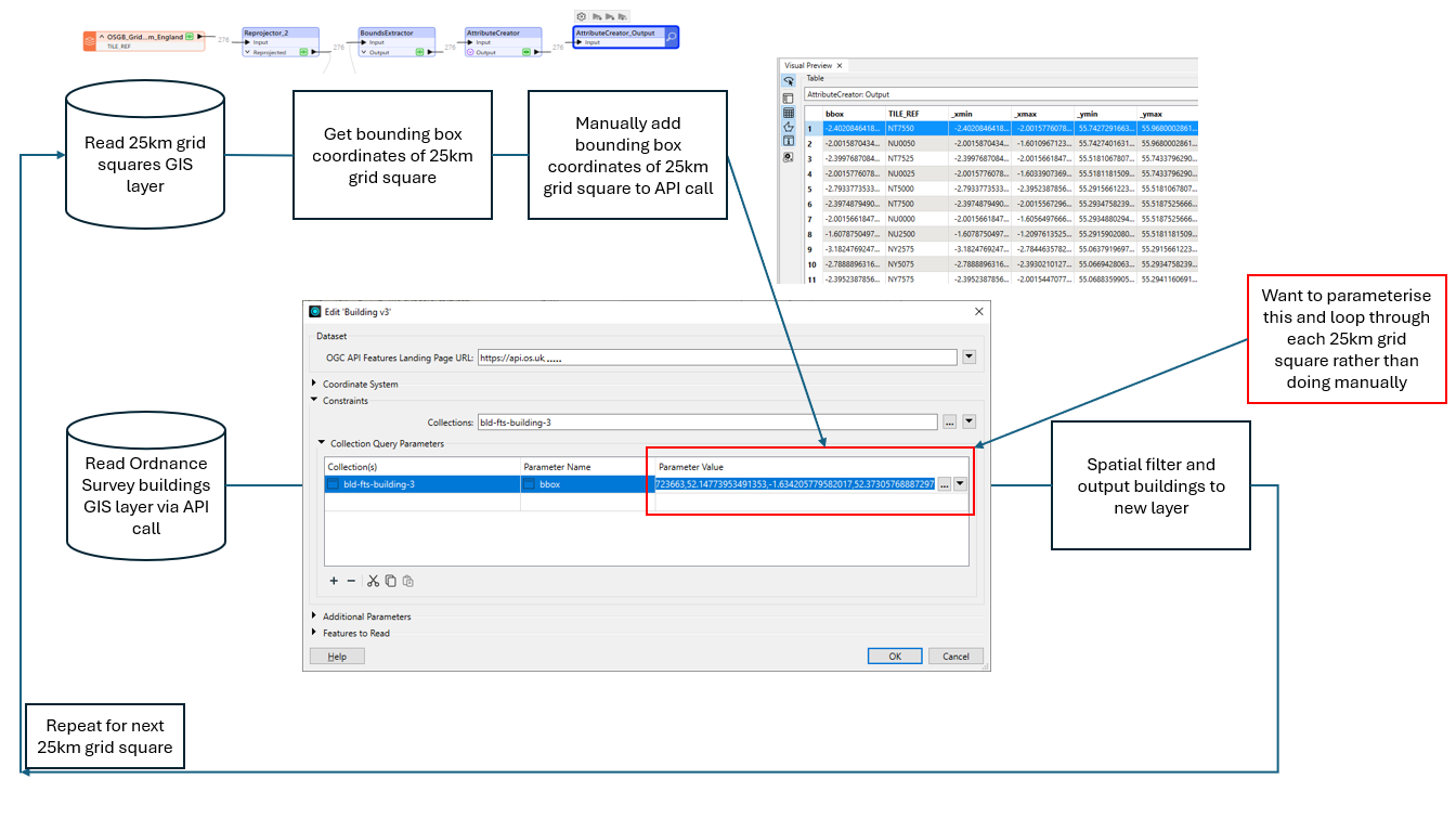
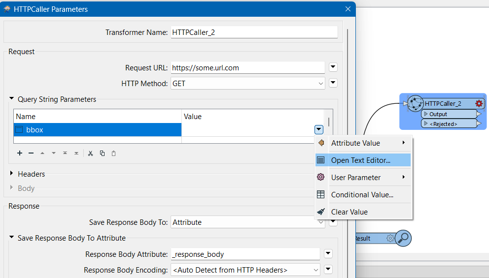
Hi I’m calling an Ordnance Survey API using a bounding box of a 25km grid square to just get the building outline features I need. I’m doing a spatial filter and buffer then to further reduce the number of features I want. I’m doing this manually i.e. putting the new bounding box values into the API call parameters then running the workbench again. I want to be able to do this dynamically via a parameter, from a list of bounding box coordinates from another file, so I can effectively loop through and spit out out a file for each grid square (I’ll append these back together later).
Is this possible? Any help gratefully received.