

Archived

ShortestPathFinder - Optimization for Multiple Paths

Related products:Transformers
  • December 18, 2017
  • 1 reply
  • 31 views

fmelizard
Safer
Forum|alt.badge.img+22

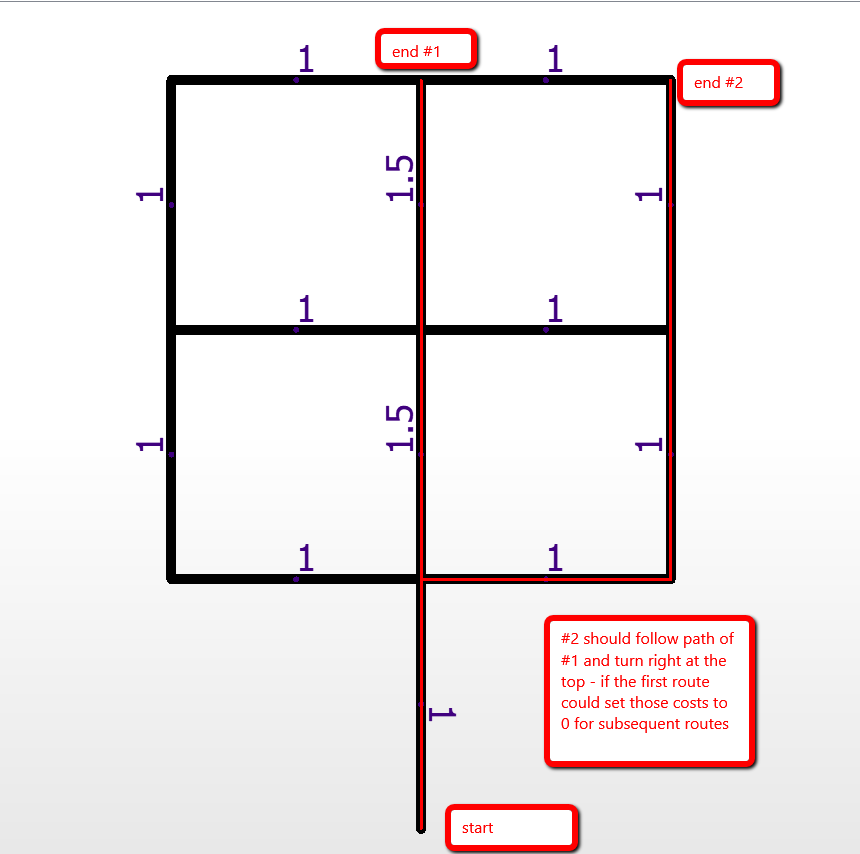
A customer asked us about a possible new option for the ShortestPathFinder. The option would assume you are sending multiple from-to lines in a specific order to the ShortestPathFinder. Once any path is output, any segments along that path would have their costs set to zero for any subsequent from-to path calculations.

Or maybe there is another algorithm we should be looking at to create optimum cost paths for shared routing along a cost network?

Comments and suggestion welcome!


With the proposed option enabled in the image below, the route to end #2 would follow route #! since its path would have set those segments to cost 0. (Note: should also work in reverse, if ends #1 and #2 are staring points)

This post is closed to further activity.
It may be an old question, an answered question, an implemented idea, or a notification-only post.
Please check post dates before relying on any information in a question or answer.
For follow-up or related questions, please post a new question or idea.
If there is a genuine update to be made, please contact us and request that the post is reopened.

1 reply

helmoet
Forum|alt.badge.img+8
  • February 2, 2018

Hi Don,

This is what we are trying to do: find a suitable place to live for our employees. They must live within a range of say a 45 minutes drive from a number of interesting places (which would be industrial plants). There are about 15 places of interest (for a starter, ideas go up to about 3000 places). In the area live a lot of people and there is a dense road network. I tried to use only the main roads (about 60.000 roads) in our network and used a networkcost calculator to calculate driving distances, much as in this article. I cancelled the computations after two and a half day of processing. My next idea is to create a grid over the area and generate for all interesting points a line from the point to the center of all grids and do a networkcost calculation on just that line. For all the resulting lines I can hopefully generate the "3D" Cost network and calculate the isochones. That, however, implies that for each loop the complete road network should be read over and over again, since the shortestpathfinder only takes one path at the time. Is that a bit of a help to you? Any ideas on solving my problem? Regards, Helmoet.