
Released

Add map component to fme server webinterface

Related products:FME Form
  • July 23, 2017
  • 10 replies
  • 100 views

stalknecht
Contributor
Forum|alt.badge.img+22

If you need a polygon,line or a point as input for a workspace then it would be nice if the user interface provides a map component to draw the object so you can use it.
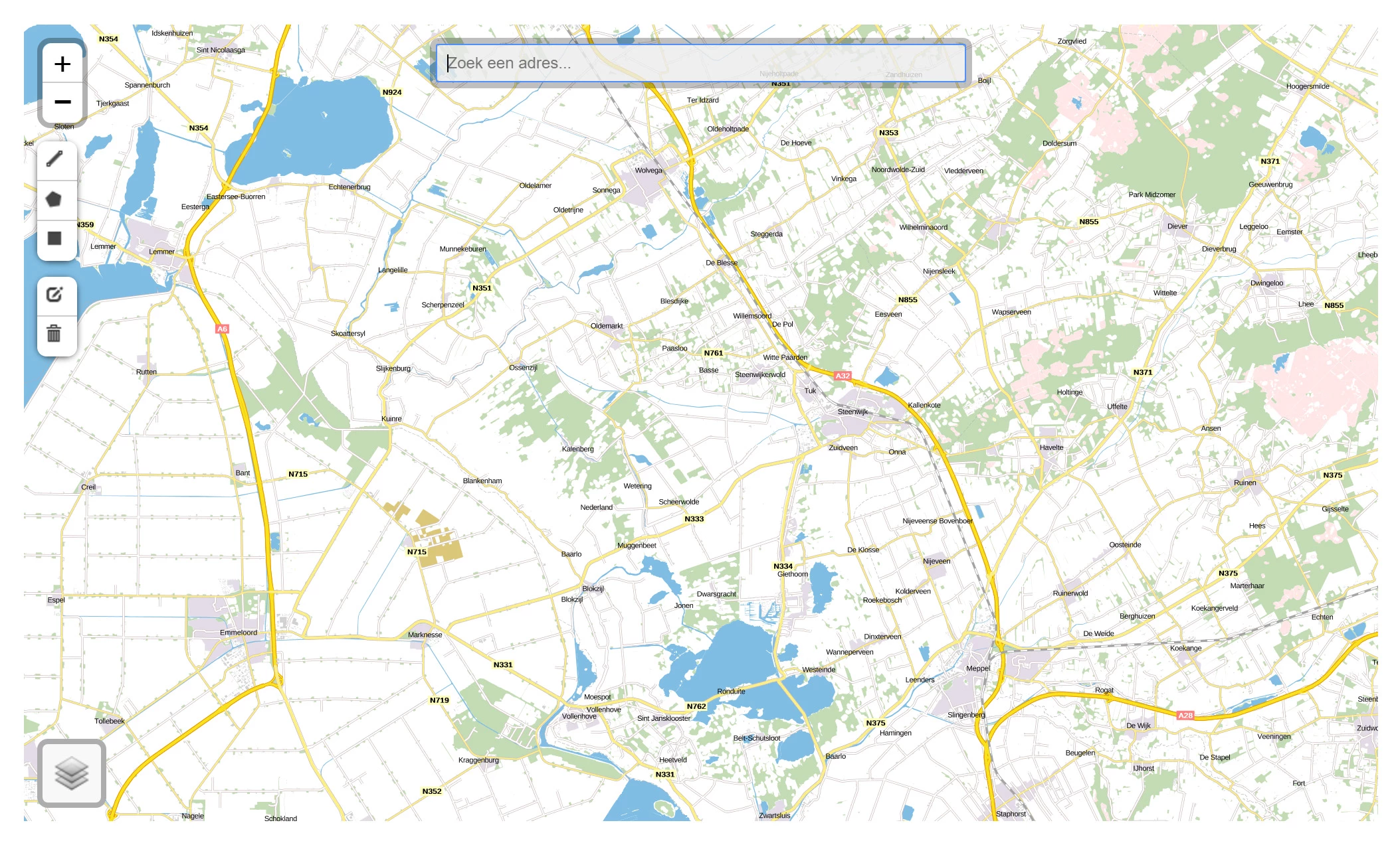
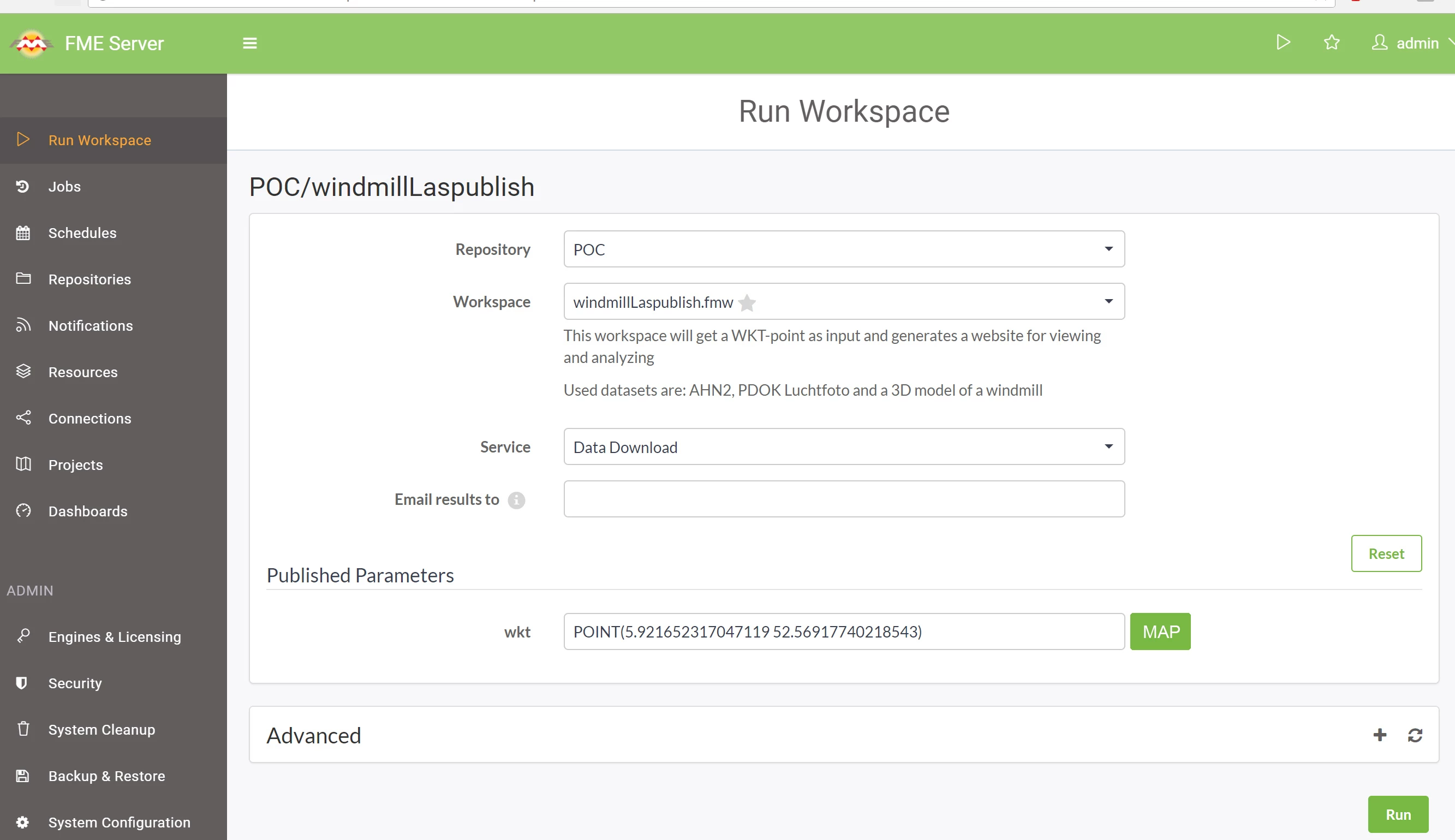
For now I use a custom form with some javascript: Wicket

But it would be nice to have it implemented into the standard web interface of FME server.

This post is closed to further activity.
It may be an old question, an answered question, an implemented idea, or a notification-only post.
Please check post dates before relying on any information in a question or answer.
For follow-up or related questions, please post a new question or idea.
If there is a genuine update to be made, please contact us and request that the post is reopened.

10 replies

redgeographics
VIP
Forum|alt.badge.img+63
Yes!! Leaflet is probably the easiest way to implement this. Adding a custom WMS/WMTS would be nice too.


rylanatsafe
Safer
Forum|alt.badge.img+14
Really cool idea! You may also be interested in Idea: Customize the FME Server Web User Interface.


stalknecht
Contributor
Forum|alt.badge.img+22
  • Author
  • Contributor
  • July 27, 2017
@RylanAtSafe Thanks for the link. I've just voted for this one also.


ekkischeffler
Contributor
Forum|alt.badge.img+7

That's a great idea. What about if this was a type of parameter? It could return FME Binary type geometry so it can be processed easily in the workspace.


itay
Supporter
Forum|alt.badge.img+19
  • Supporter
  • July 15, 2019

Great idea @stalknecht one little addition...make it available via the shareable URL!


kweller
Contributor
Forum|alt.badge.img+8
  • Contributor
  • October 31, 2019

Or just a simple lat/long box. I guess that's just a polygon with a constraint on how it is drawn.


LizAtSafe
Safer
Forum|alt.badge.img+21
  • Safer
  • March 13, 2020

Hi @stalknecht,

This has been released for FME Server 2020.0. For a walkthrough on how to use the new functionality, please see the article Using the Geometry Picker in FME Server.

'


takashi
Celebrity
  • March 14, 2020

It's a great parameter, but unfortunately it's inconvenient in the Eastern Hemisphere, since the longitude values would always be negative values.

For instance, the parameter generated this GeoJSON text when I drew a polygon in Tokyo, Japan.

{"type":"Polygon","coordinates":[[[-220.238907,35.678354],[-220.239697,35.676346],[-220.236298,35.675663],[-220.234599,35.677504],[-220.238907,35.678354]]}


We have to offset x-coordinates by +360 before using the resulting polygon as a spatial filter...

'


takashi
Celebrity
  • March 14, 2020

Ah, this seems to be depending on which hemisphere the initial bounds is belonging to. After I set the initial bounds as an area in Tokyo, longitudes became correct positive values.

Then, I noticed that the "Zoom Initial Bound" moves the map to Surrey always...

'


It seems that there still is a room to improve it.

In addition, it would be ideal if these configuration would be added to the parameter definition.

  • Minimum Zoom Level
  • Maximum Zoom Level
  • Maximum Extents for Map Display
  • Additional Layers (any web map tiles)

takashi
Celebrity
  • March 14, 2020

If you extend the Geometry Picker window, tiles in right and bottom would disappear.

'