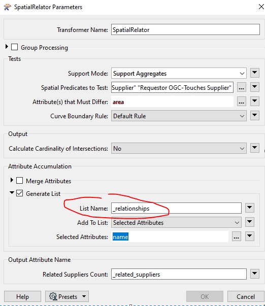
Hello everyone and thanks in advance. I have a geojson of polygons with the fields 'name' and 'area'. I want to know which polygons touch each other but have different area. I have reached the spatial relator with the predicate 'requestor touches supplier'. This generates an output with the 'related_suppliers' field, which indicates the number of polygons that touch the feature. It also generates a list, which I think is where the solution lies.


I've come this far but I don't know how to continue. As a final result, I would like a simple table where each record is a neighborhood relationship between polygons.


Thank you so much,


Pol
 

image 

Update: I have used the ListExplorer to get the table with neighbourhood relations but I get this error... once passed 7/71 features..


image.png


Update: I have used the ListExplorer to get the table with neighbourhood relations but I get this error... once passed 7/71 features..


image.png

As there are 0 related suppliers there is no list to explode which is why you see that error. If you test for _related_suppliers > 0 and then send only that output to the list exploder it will resolve that error.


As there are 0 related suppliers there is no list to explode which is why you see that error. If you test for _related_suppliers > 0 and then send only that output to the list exploder it will resolve that error.

Thank you very much!


Pol


Reply