Depends on what you are trying do and the data input.
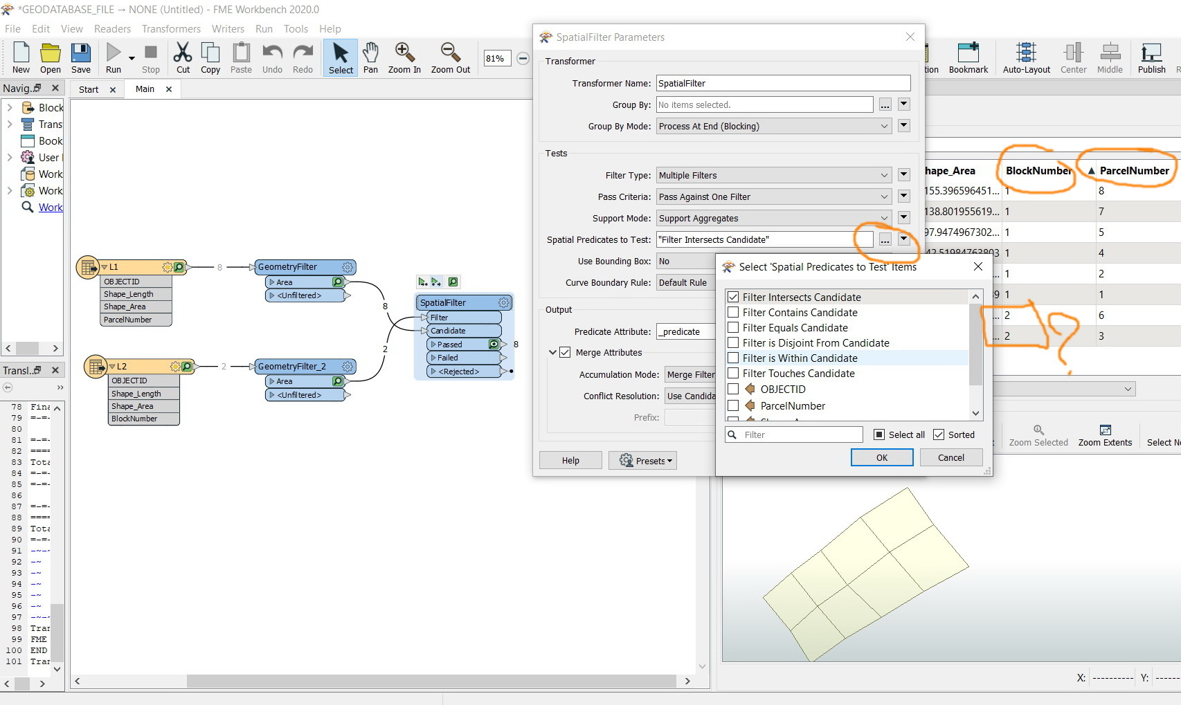
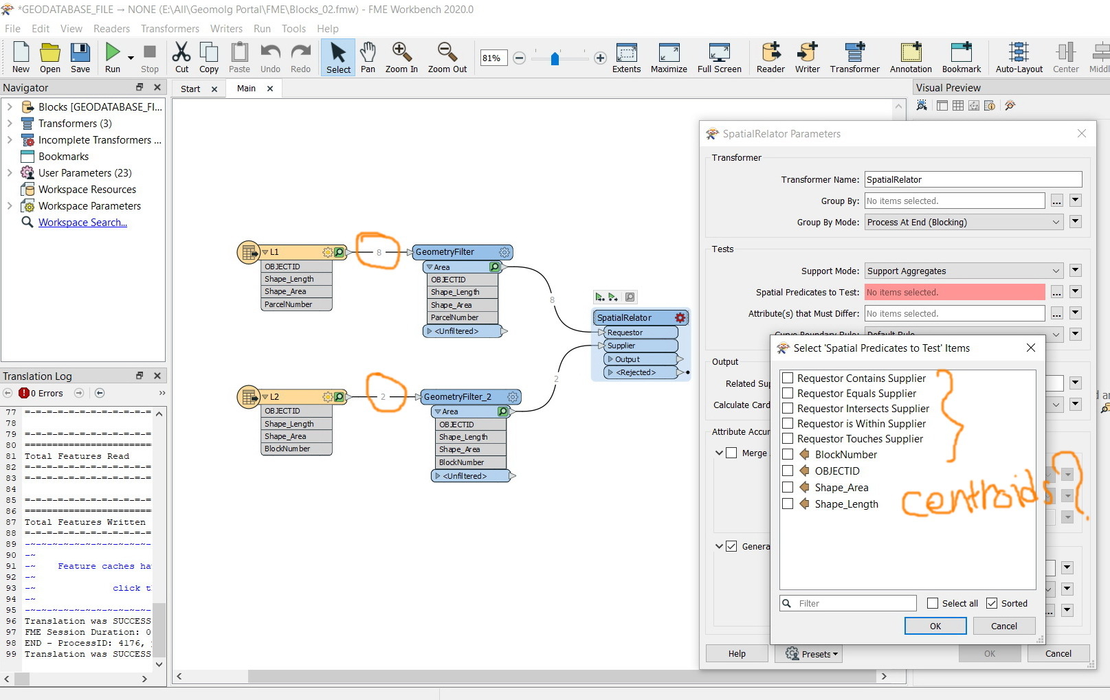
SpatialRelator will give you intersects, overlaps, identical, etc. like ArcMap.
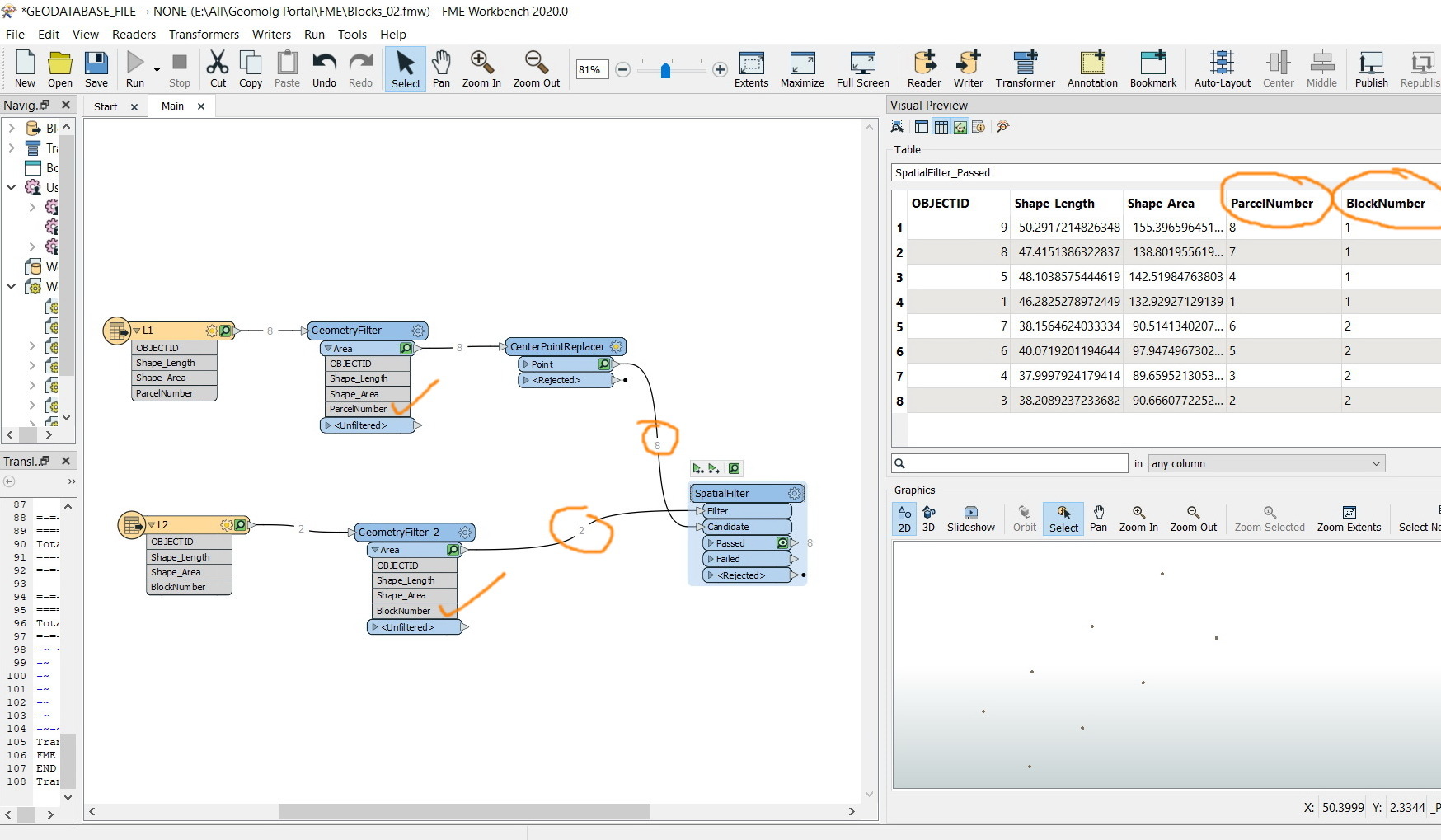
In many cases you may be looking to fit not so perfect data on top of other data and you can use a PointOnAreaOverlay to bring the data together by converting your intersect layer to points, overlaying, and merging attributes.
After the intersect, use a FeatureMerger with the resulting intersect connected to the layer you want to attribute and you will inherit the values.
There's always 5-10 ways to do the same thing in FME and that's what makes it so great!
second the PointOnAreaOveralyer approach. Use a center point replaced on the smaller areas (1,2,3...7,8) then the SpatialRelator and FeatureMerger as described above
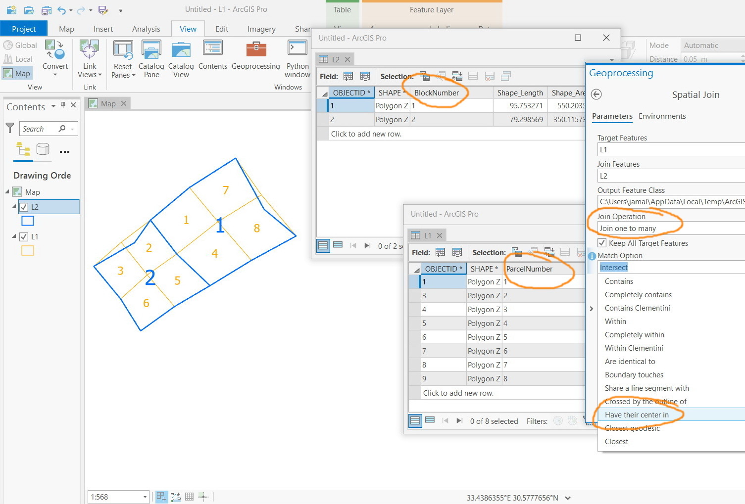
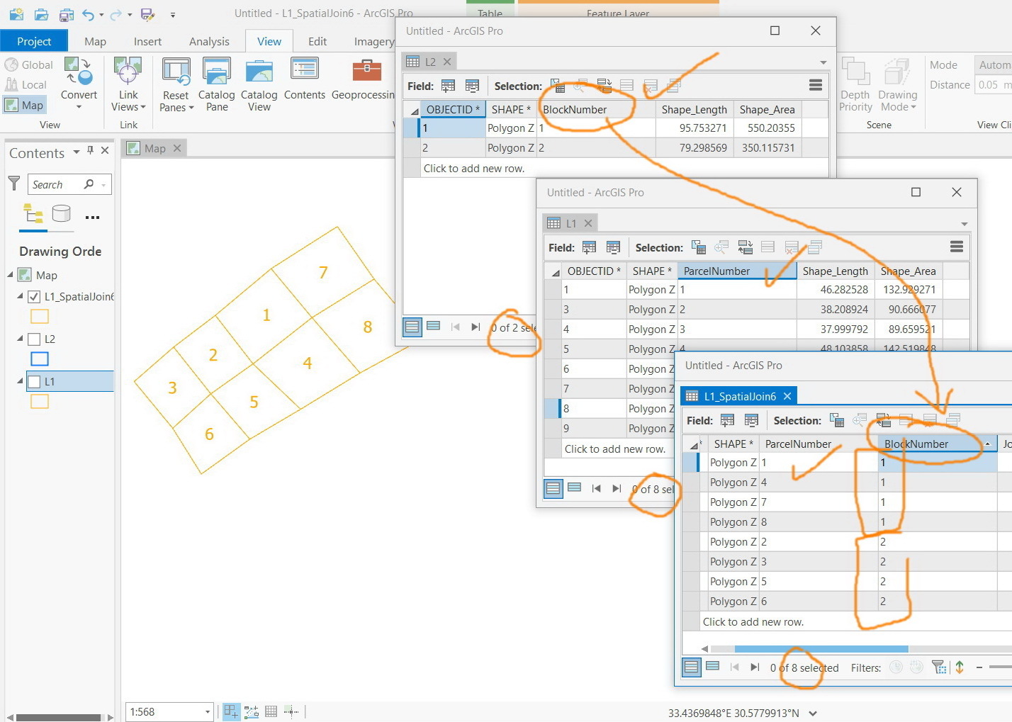
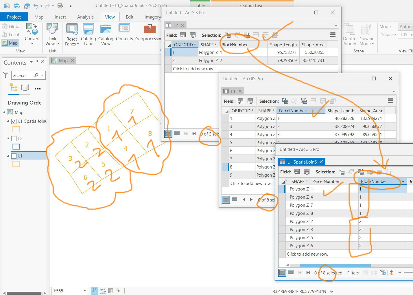
What I wanted here is to transfer the block number to parcels that THEIR CENTROIDS LIE within the block boundary. This can be done with one tool in ArcGIS (Spatial join).
The output I’m expecting appears in the second screenshot as a field for the “blocknumber” is added to the parcel layer and thus each parcel gets block number it lies within
The two fields (parcelnumber and blocknumber) are now available on the point layer. What I wanted is to transfer them to the parcel polygon layer.
How this can be performed?
The two fields (parcelnumber and blocknumber) are now available on the point layer. What I wanted is to transfer them to the parcel polygon layer.
How this can be performed?
Use the PointOnAreaOverlayer, under attribute accumulation select Generate List On Output 'Area'. You'll then have a list of (the selected) attributes from the point layer
Thank you. I have already posted it in a new thread to better explain the issue