I have a shapefile containing points distributed every 5 meters in a regular mesh of 100 rows x 100 columns. I have to create a shapefile with points of this regular mesh located every 10 meters, or 20 meters, ... (always a number multiple of 5) to get a sparse mesh from the original.


I there any FME Transformer that can help to do this task?

Any suggestion or idea would be really appreciated. Thank you !


Are the coordinates of the points multiples of 5?


Are the coordinates of the points multiples of 5?

Thanks @ebygomm​ ,

No, the coordinates of points are rounded UTM coordinates and these points are measuments equally spaced over terrain


Thanks @ebygomm​ ,

No, the coordinates of points are rounded UTM coordinates and these points are measuments equally spaced over terrain


It still should be possible with a bit of maths, but hard to say exactly what without seeing the data


Thanks @ebygomm​ ,

No, the coordinates of points are rounded UTM coordinates and these points are measuments equally spaced over terrain


Thank you very much for your help, @ebygomm​ , I have attach a very small sample data in Shapefile format.

I have simplified at maximum the file structure, because the real data have hundred of attributes.

In this sample data the distance between points is 20 meters, but the idea is to obtain a mesh with a points located 40 m, 80m, ... from each other.


The real problem is that I have a very huge file of points (tens of millions) equally spaced.

I am able to work with this points at map escale E1:5,000 but I have to generalize this points to increase speed of rendering for map escale E1,000,000.


Any idea or suggestion about generalizing points for optimizing visualization at multiple scale maps are welcome. Thank you !


Thanks @ebygomm​ ,

No, the coordinates of points are rounded UTM coordinates and these points are measuments equally spaced over terrain


Have you considered creating a Point Cloud from your points and then using a Point Cloud Simplifier?


Thanks @ebygomm​ ,

No, the coordinates of points are rounded UTM coordinates and these points are measuments equally spaced over terrain


I thought PointCloud structures was only for LAS files (specific format for Lidar points).

OK, I will try Point Cloud Simplifier Transformer and also Point Cloud Thinner as explain here: https://docs.safe.com/fme/html/FME_Desktop_Documentation/FME_Transformers/Transformers/pointcloudsimplifier.htm

 Thank you @ebygomm​ !


Thanks @ebygomm​ ,

No, the coordinates of points are rounded UTM coordinates and these points are measuments equally spaced over terrain


Use a PointCloudCombiner (ignore the name Combiner) to create the Point Cloud from your shape file first


Thanks @ebygomm​ ,

No, the coordinates of points are rounded UTM coordinates and these points are measuments equally spaced over terrain


Yes, I'm just doing that right now.

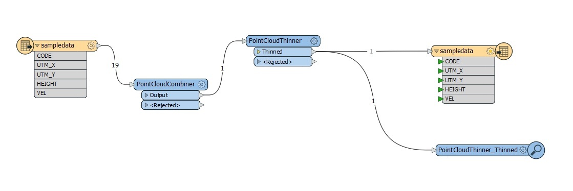
I have used: shp-reader -> PointCloudCombiner -> PointCloudThinner -> shp-writer

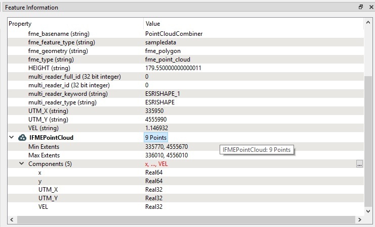
Also, I can preserve attributes of individual points as components with "Attributes to Preserve as Components" section in the PointCloudCombiner parameters.

I'm trying to undersand why from 19 input points, PointCloudThinner generates 9 (it's ok), but in the workflow schema you can only see 1 (???)

 schemapCloudThinner


Thanks @ebygomm​ ,

No, the coordinates of points are rounded UTM coordinates and these points are measuments equally spaced over terrain


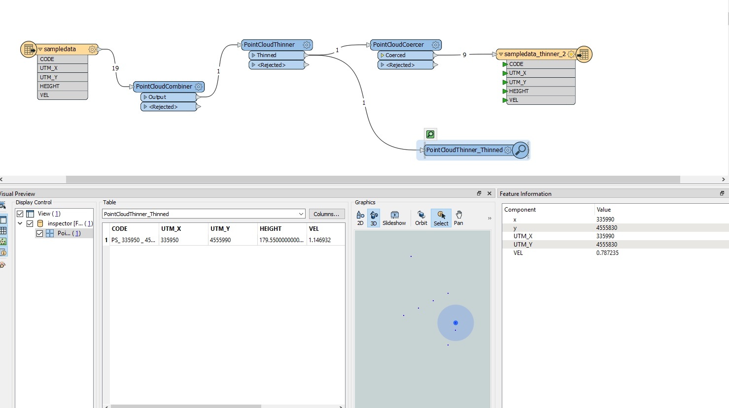
This combination works: shp-reader -> PointCloudCombiner -> PointCloudThinner -> PointCloudCoercer -> shp-writer

Thank you @ebygomm​  for your help !

schema2


Reply