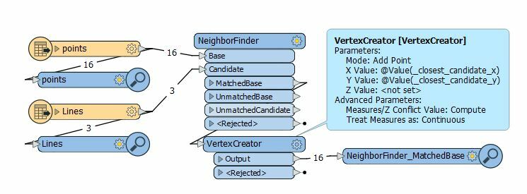
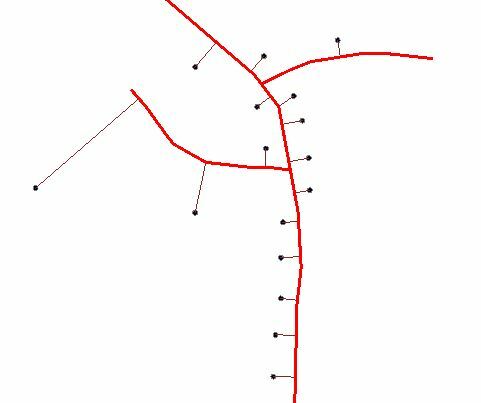
i have a point dataset showing the location of road furniture, and also a line dataset showing the geometry of a road. I need to create a line between the existing point and the road line, but cant get my head round where to start.
Any suggestions welcome...


 The result is each point with a line to the nearest coordinate on the line.


