
")

Hi! I’m new with FME Workbench. I’m used to using QGIS or ArcGIS, in where you can easily find and configure a map layer for your vector layer. In this case, I found Workbench 2025 doesn’t come with background maps pre configurated, so I came up with a simpler way of having one, without the need of a token.
As you may know WMS stands for Web Map Service. It's an OGC standard for serving up map images over HTTP.
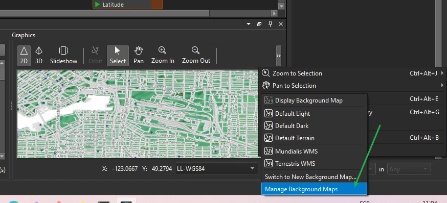
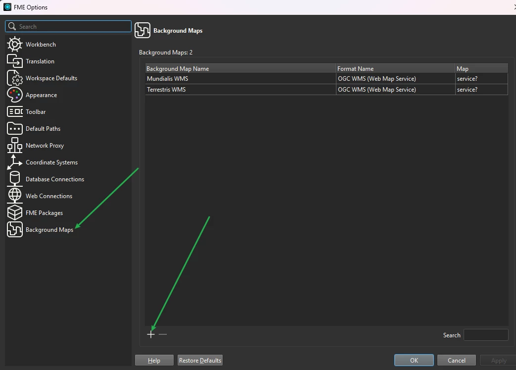
Fo adding a new background map:
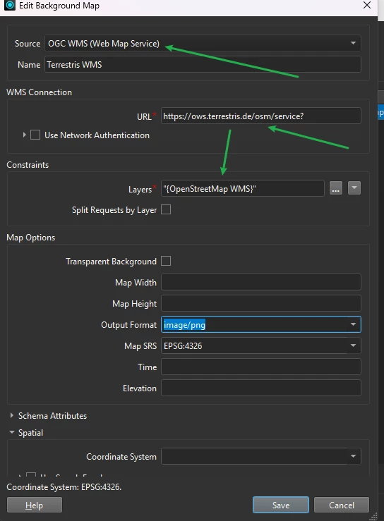
In this particular case I’m using Terrestris free WMS map, beacuse they offer free access (depending on the scale you need) to the WMS service.
https://terrestris.de/en/products/free-osm-wms/
Color: https://ows.terrestris.de/osm/service?
Grayscale: https://ows.terrestris.de/osm-gray/service?
You can find more free options avaliable at the following link:
https://wiki.openstreetmap.org/wiki/WMS#OSM_WMS_Servers