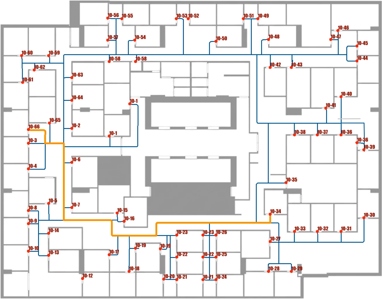




I revisited an old scenario: turning raster floor plans into routable indoor networks. Back in 2017 I drew the network by hand in MicroStation. This time I wanted AI to do the work.
First, I asked Gemini to do the whole network. It looked convincing, but a closer inspection revealed disconnected sub-networks and missed offices. So I split the job.
Gemini does only small perception tasks: declutter the area labels, mark office doors, connect them with orthogonal corridors, and isolate the result to a clean black-and-white raster. It also returns door coordinates and office numbers as JSON (Gemini is currently the only AI that can do this operation quite accurately). That's where the AI's role ends, the rest is pure, traditional FME.
I turn the JSON into vector nodes, vectorize raster to polygons, extract centerlines, extend them with DangleExtender (my new CT - https://hub.safe.com/publishers/safe-lab/transformers/dangleextender) to close the gaps at office points, and snap into a connected network. ShortestPathFinder confirms the network works.
A couple of notes: asking Gemini for door coordinates directly doesn't work well — it detects every door but the pixel coordinates aren’t great. Reading pre-placed dots off the raster is far more reliable. And the color isolation step exists only because the model's output is JPEG-noisy; letting Gemini clean it beats using RasterExpressionEvaluator.
Full walkthrough with images here: LinkedIn. Workspace on FME Hub.