


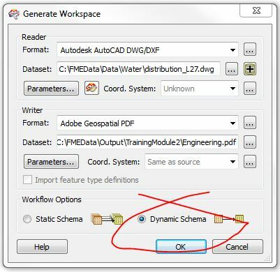
I have generated a workspace that does a simple read of an AutoCAD .DWG file and then writes it out in the Adobe Geospatial PDF format. My workspace finishes successfully for the one .DWG file that I supply to it while testing within FME Workbench.
My problem is that when I upload a different .DWG file (with different schema) the workspace no longer can finish successfully. I have to make this work because I will have .DWG files being uploaded to my server from any number of end users who could have created their .DWG files differently.
Can anyone give me some pointers to allow my request to work properly? I appreciate any support. When I find out how to resolve the answer, I will post here for anyone else who may have this problem down the road.
Thanks in advance!


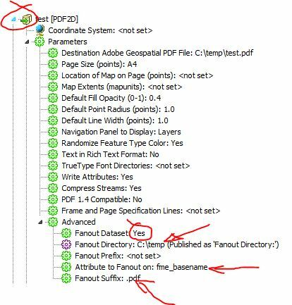
 Now, I have modfied and tested my workspace because the supplied .DWG file I am using I know has been created with the projection of "Pennsylvania State Plane South 83 Feet" I know that by defining the souce project as this value, I can acheive the correct result. However, if I use either "UNDEFINED" or "UNDEFINED-FOOT", I end up in the middle of the earth (which is obviously not desired)