
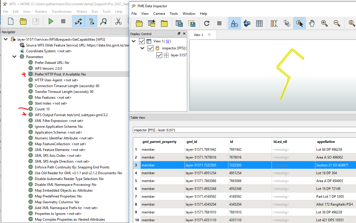
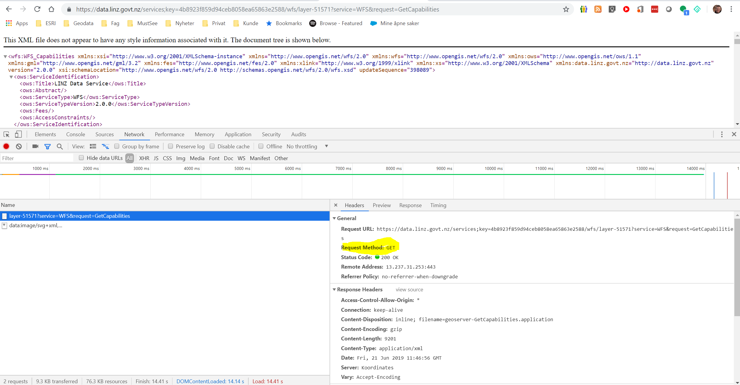
I am trying to use a WFS FeatureReader. I'm not getting any errors and it is outputting the schema and initiator but not the actual layer that I have selected


It's almost as if it isn't in the correct coordinate system however I have cheked multiple times and with multiple WFS links and it's just not working.


I am trying to select the "WFS Output Format" but there are no options in the drop down menu. I'm wondering if this is the issue? Or is anyone else having the issue of WFS FeatureReaders not wokring. I'm using FME 2019

WFS's can be a pain, to assist I think you have to provide the URL to the GetCapabilities call (or save the response and provide it here). Specifying the output format has been a key in some cases - yes.


WFS's can be a pain, to assist I think you have to provide the URL to the GetCapabilities call (or save the response and provide it here). Specifying the output format has been a key in some cases - yes.

The WFS is https://data.linz.govt.nz/services;key=4b8923f859d94ceb8058ea65863e2588/wfs/layer-51571?service=WFS&request=GetCapabilities


I'm having issues with all of the LINZ WFS actually with different inputs.


Hi @ctsmithgis thanks for the GetCapabilities. My knowledgde in WFS is a bit limited and I might be mixing WFS 1.x and 2.x nomenclature in my response, and some might even be mistakes and/or errors.

GetCapabilities


The service supports both GET and POST (AGOL just support POST). The outputFormat "section" describes a lot of possible output formats, many of them non-standard according to WFS specs (for example KML). If my understanding is correct output formats depend om the WFS version of your request (for the standard outputs). The safe thing is to ask for the standard outputformat probably (?).

Test


- version: I used 2.0.0


- output format: text/xml; subtype=gml/3.2 (I believe this is standard for 2.0.0)

If You choose to go for WFS versions 1.0.0 or 1.1.0 you might have to change outputformat accordingly. This got me going (with FME2018) .


An image attached. Please note I limited the request to 10 objects only


Hi @ctsmithgis thanks for the GetCapabilities. My knowledgde in WFS is a bit limited and I might be mixing WFS 1.x and 2.x nomenclature in my response, and some might even be mistakes and/or errors.

GetCapabilities


The service supports both GET and POST (AGOL just support POST). The outputFormat "section" describes a lot of possible output formats, many of them non-standard according to WFS specs (for example KML). If my understanding is correct output formats depend om the WFS version of your request (for the standard outputs). The safe thing is to ask for the standard outputformat probably (?).

Test


- version: I used 2.0.0


- output format: text/xml; subtype=gml/3.2 (I believe this is standard for 2.0.0)

If You choose to go for WFS versions 1.0.0 or 1.1.0 you might have to change outputformat accordingly. This got me going (with FME2018) .


One other thing. It seems the webserver/IIS is not allowing POST. That could be the reason for "Prefer HTTP Post if available" fails if You try


Reply