")

Hi,
I’m currently struggling to figure out how to convert a LOD2 3D-Multipatch from a FileGDB into CityGML. I do currently not have a program avail
able to open or edit CityGML files, but it might be important at a later stage to be able to convert the data back into CityGML. Is it generally possible to convert any multipatch into a CityGML file at a later stage, or is important information lost in the process?
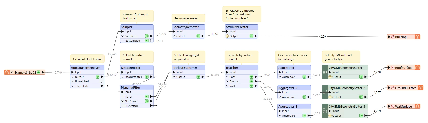
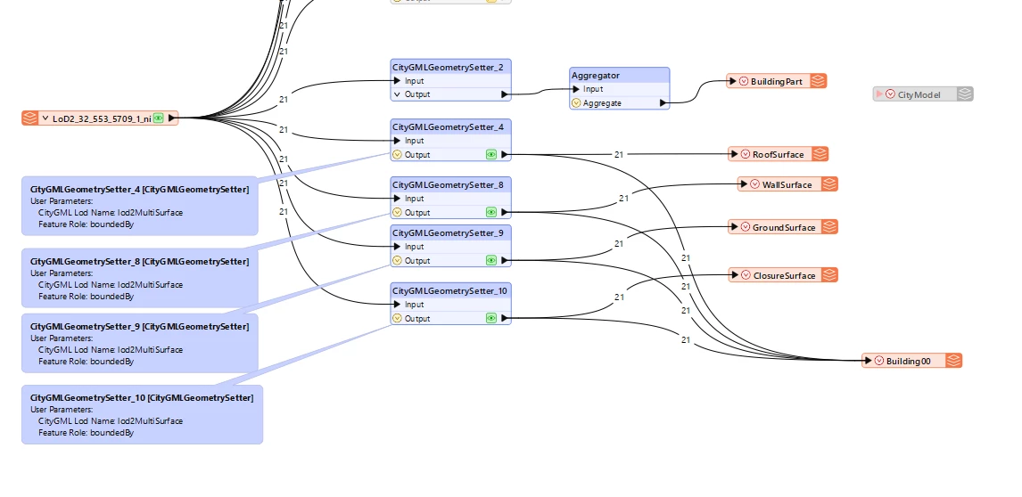
How do I ensure that a distinction is made between Wall, Roof, Ground, and Closure Surface? Or is it all simply classified as Building?
I've already looked at the website Writing CityGML from FME, but unfortunately, I still don't know how to proceed. How do I know which ‘citygml_lod_name’ value to use? If multiple values yield a result, should I use all of them parallel?
I would be grateful for any tips to help me understand this better…
Thank you!
My first attempt of a workbench...
")