Question

How to calculate x,y coordinates from point feature class as same as ArcGIS calculate

  • December 9, 2013
  • 5 replies
  • 951 views

I have a point POI (Points of Interest) feature class. I need to calculate X and Y coordinates (Lat\\Long ) in a FME workbench process. How do I do this with FME workbench ?  


Can someone help me to model this or any other direct converter 


(Feature class has [shape] field.) 
Did this help you find an answer to your question?

5 replies

fmelizard
Contributor
Forum|alt.badge.img+17
  • Contributor
  • December 9, 2013
Hi,


Try the CoordinateExtractor, with an index of 0 for points.


Itay

david_r
Celebrity
  • December 9, 2013
Hi,


to add to Itay's response: if your input feature class isn't already in LatLon, insert a CsmapReprojector before the CoordinateExtractor to reproject the geometry first.


David

  • Author
  • December 10, 2013
Thank you gentlemen. I will try this


@David : Feature atributes never show coordinates as it is encripted  in geometry field(Shape) we need x,y coordinates in seperate column for simple (ArcGIs flex API based) application to show points on map. Application has compiled and  written to use x,y coordinates where we cant change.


Appreciate your reply. 

david_r
Celebrity
  • December 10, 2013
Hi,


yes, that's correct. My point was that the CoordinateExtractor will extract the x,y coordinate values in the same coordinate system as the input geometry. If this differs from LatLon, you will have to do some reprojections to ensure you get the x,y in your chosen projection.


David

  • June 17, 2016

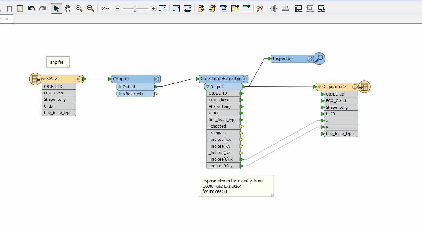
use transformer chopper, then coordinate extractor (expose elements x and y)


Cookie policy

We use cookies to enhance and personalize your experience. If you accept you agree to our full cookie policy. Learn more about our cookies.

 
Cookie settings