
Dear all,
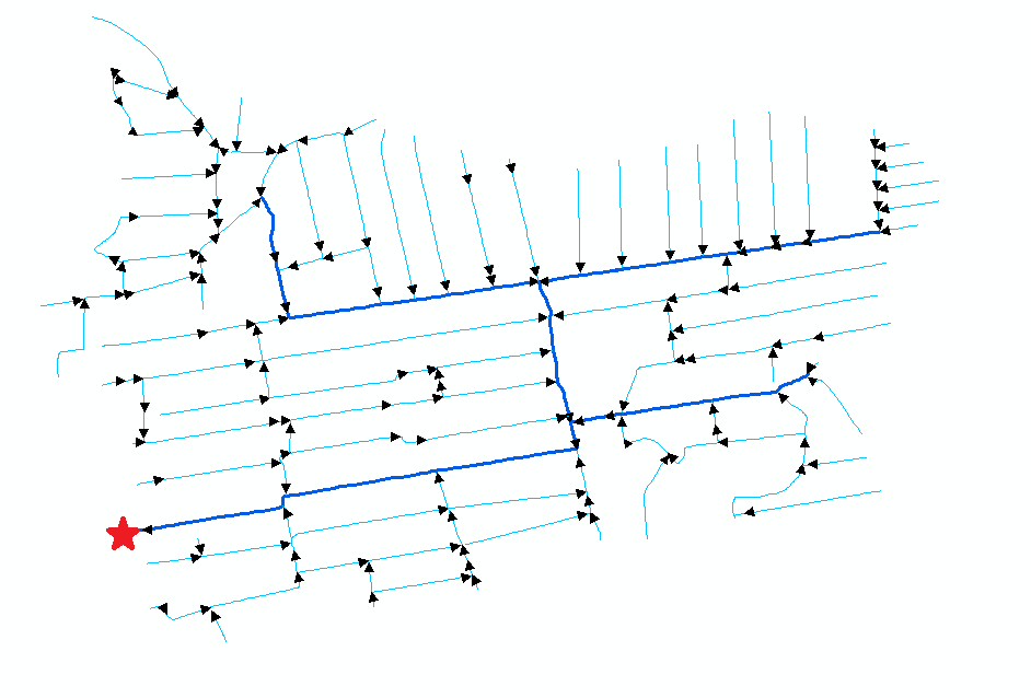
I am currently working on a project where I assess watershed areas upstream of several ditches. The area is a polder area (no significant internal differences in elevation) with flow direction somehow incorporated into the ESRI shapefile (see arrows in below figure), no clue how. In the end, all ditches lead to the red star. I have aready calculated the watershed area for each individual ditch.
The next step would be to somehow add a column in my shapefile where all upstream watershed area's are added together to find the 'total watershed area' that provides the water flowing through the ditches.
Some things to note:
- Some ditches split into 2 other ditches. These, we assume, both get 50% of the water that flows from the upstream 'parent' ditch
- Dark blue lines and lighter blue lines are major- and minor channels/ditches, and can be regarded as similar in function
- Arrows show the direction of flow in all ditches
- Since the area is a flat polder, elevation cannot be a variable (entire area is slightly below sealevel)
- Ideally, the solution should be workable in FME Workbench 2018.1. If the 2020 version is needed, no biggy, but then I will have to convince the boss to update the software.
- I am relatively new to FME, so to whoever has the answer: please treat me like a child :).
EDIT:
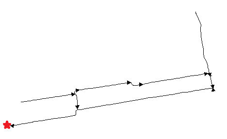
This is the sample data I'm working with. the picture shows the cutout of the original file I'm using to experiment (red star is at the same location).
I've tried to see what the NetworkFlowOrienter transformer shows, but it doesn't give me the same direction as the lines from ArcGIS do. Is there some way to manually make FME preserve line direction? In the SampleShapefile.zip there is a dummy variable 'Area' that i want to sum up (the line going to the red star should be the sum of the lines that connect to it plus its own dummy value). Hope this makes clearer.
Cheers,
Laurens

