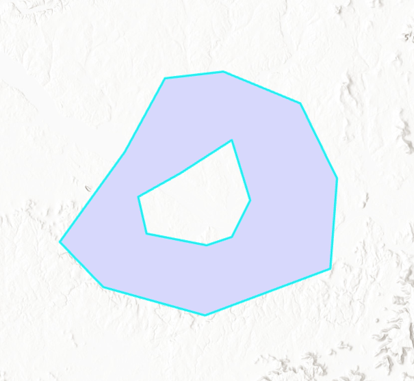
I could use some help in understanding how donuts are stored in OSM XML. Or more specifically, why FME Data Inspector is not constructing the donut from the XML. Here is the simple shapefile test data I’ve created.

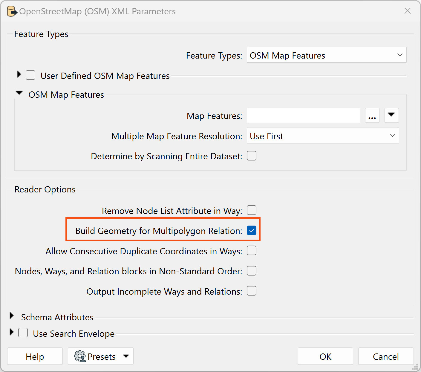
In FME, I’m writing out the OSM using the normal writer:

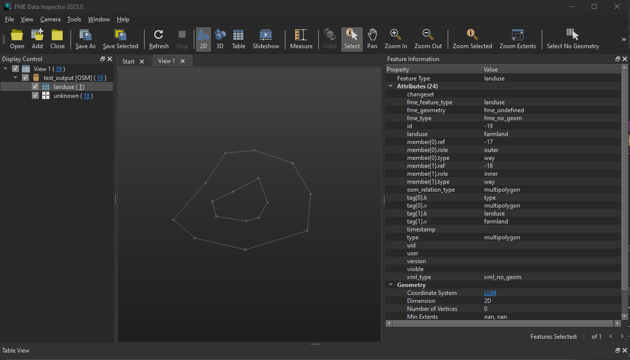
When I read that OSM back into Data Inspector, it doesn’t recognize the shape as a multipolygon. The geometry type is fme_no_geom:

The XML code is below. I’m seeing the relation present, so I’m not sure what else is required.
<?xml version="1.0" encoding="UTF-8"?>
<osm version="0.6">
	<node lat="34.6596384" lon="-87.0320968" id="-7"/>
	<node lat="34.5631538" lon="-86.8849822" id="-10"/>
	<node lat="34.7427899" lon="-86.9769288" id="-8"/>
	<node lat="34.4741373" lon="-86.9217608" id="-4"/>
	<node lat="34.6293808" lon="-86.7401662" id="-2"/>
	<node lat="34.5063457" lon="-87.0619795" id="-5"/>
	<node lat="34.5536885" lon="-86.9194622" id="-16"/>
	<node lat="34.5669396" lon="-87.0022141" id="-15"/>
	<node lat="34.6350549" lon="-86.9562408" id="-13"/>
	<node lat="34.5271799" lon="-86.7493609" id="-3"/>
	<node lat="34.7144522" lon="-86.7907369" id="-1"/>
	<node lat="34.6047883" lon="-86.8596968" id="-11"/>
	<node lat="34.6728726" lon="-86.8849822" id="-12"/>
	<node lat="34.5574747" lon="-87.1217448" id="-6"/>
	<node lat="34.6085723" lon="-87.0137075" id="-14"/>
	<node lat="34.750345" lon="-86.8964755" id="-9"/>
	<way id="-17">
		<nd ref="-1"/>
		<nd ref="-2"/>
		<nd ref="-3"/>
		<nd ref="-4"/>
		<nd ref="-5"/>
		<nd ref="-6"/>
		<nd ref="-7"/>
		<nd ref="-8"/>
		<nd ref="-9"/>
		<nd ref="-1"/>
	</way>
	<way id="-18">
		<nd ref="-10"/>
		<nd ref="-11"/>
		<nd ref="-12"/>
		<nd ref="-13"/>
		<nd ref="-14"/>
		<nd ref="-15"/>
		<nd ref="-16"/>
		<nd ref="-10"/>
	</way>
	<relation id="-19">
		<member type="way" ref="-17" role="outer"/>
		<member type="way" ref="-18" role="inner"/>
		<tag k="type" v="multipolygon"/>
		<tag k="landuse" v="farmland"/>
	</relation>
</osm>
I’m using FME2023 build 23332. What could be the issue here?


