Question

Geotiff to 3D pdf


I have a raster with z-values and would like to export it to a 3D pdf, with some specific symbology.

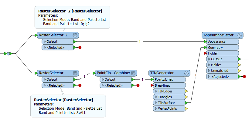
I have already successfully created a 3D pdf with contour data (following this tutorial), transformed into a TIN and then overlaid by a raster, but the resolution is not good enough so I would like to use the original raster.

Any help is highly appreciated and I hope that somebody can guide me in the right direction on which transformers to use!


2 replies

Userlevel 2
Badge +17

Hi @barbaras,

If your raster only has height values, you can send it to a PointCloudCombiner to convert it into a point cloud, then send the point cloud to a TINGenerator to create the surface.

If the raster has both height and image information in it, you can use RasterSelectors to select the bands you want to use for both the point cloud extraction and to apply as a texture on the TIN surface.

Hi Dave,

Sorry for the late reply. I was unfortunately not able to produce a nice looking 3D pdf with the suggested solution. First, it took ages with my pdf, so I tried it with a much smaller one. But something didn't quite work. We prepared now the pdf's with bathymetry lines instead of rasters and that gave us good enough results. The pdf's are just an additional delivery to an extensive amount of data and files, so not that important. Thank you so much for your help, Dave!

Reply