Hey all,

I'm just recently working with FME. We are using fme for converting xyz pointclouds to geotiff format. Converting is not longer a problem (thanks to the fast help here).

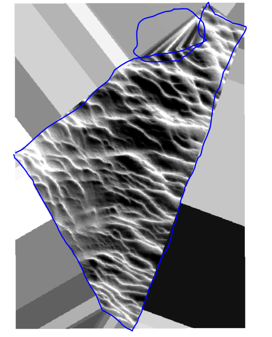
But now i'm looking how i can set a boundrie for the geotiff. (drawn in blue)


As you will see in picture i have added here the geotiff also gives elevation where there is no data. (blue circle).

I know that in C3D i can set a boundrie for the geotiff or give a max triangle length(witch is not the best solution but also works for this problem). Is there anything like that possible in FME?

Many thanks,
Koen

Hi @venkenk, I suppose that you created the raster with the RasterDEMGenerator.

If you create another raster with the NumericRasterizer (Fill Background with Nodata: Yes) from the same point cloud, you can convert it to a polygon representing the data area with the RasterExtentsCoercer (Extents Type: Data Extents). You can then clip the current DEM raster by the polygon to get rid of the unnecessary part.

Note: Depending on the data condition and parameters setting in the NumericRasterizer, the RasterExtentsCoercer could create an aggregate (multi-part polygon) or a donut (having holes). Maybe you will have to determine the parameters in the NumericRasterizer with trial and error and/or use some additional transformers such as DonutHoleExtractor in order to clean the polygon up.


Reply