
I have been working on FME for a while now. But not much with geo-related issues.

A user receives requests :  With and without address. Requests without addresses do contain coordinates (in both RD-Amersfoort and ETRS89)

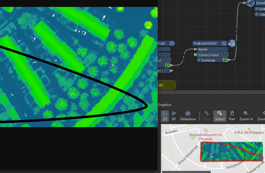
The user would like to see a map with a polygon in it.

What steps/attributes do I need to realize this?

I have already tried with the following attributes : AttributeReprojector, AreaBuilder, HullAccumulator


Please give your advice and tips

Not sure if I understand correctly. Do the records with adresses also have coordinates? If not, you will need to georeference these first.

Do you want to have a polygon around the point features? The HullAccumulator is indeed one way to accomplisch this.

Workflow can be something like:

  • VertexCreator to get points from coordinates.
  • HullAccumulator to generate polygon around points.

Thanks for your response.Attached 2 attachments.The result in the background is special.If I use AttributeReprojector from RD to SPHERICAL_MERCATOR the result remains the same.

hopefully you can help me further


Thanks for your response.Attached 2 attachments.The result in the background is special.If I use AttributeReprojector from RD to SPHERICAL_MERCATOR the result remains the same.

hopefully you can help me further


When you use the AttributeReprojector, only the coordinates in the fields are changed, not the proints.

  • Use a VertexCreator to create points from x_coord and y_coord. (Mode = Replace with Point)
  • Use a CoordinateSystemSetter to set the projection to EPSG:28992. This is Netherlands RD new.


Thank you! That looks much better!

Returning to my 1st post. Now I want to collect this result (polygon) in combination with, for example, a WMS layer and offer it to a user via email. (I am aware of the use of FME Hub Emailer)


What do you want to email? An image with the polygon and the WMS as background?


What do you want to email? An image with the polygon and the WMS as background?

if it's possible, that would be really great


Steps are:

  • Feed the polygon into a FeatureReader.
    • Read the WMS
    • Spatial Filter = Bounding Boxes OGC-intersect.
    • Map SRS = EPSG:28992
  • Feed the raster and the polygon in a MapnikRasterizer to combine the 2 into one raster.
  • FeatureWriter to write this to a file.
  • Emailer to mail the result.

Attached sample demonstrating this.


Another way to do it would be to use the HTMLReportGenerator to create an HTML file with a Leaflet map with the WMS and the polygon in it. But this will probably take some more time to create and will not return a static result.


Attached sample demonstrating this.

Thank you very very much for your FME project as an example !


The only thing that strikes me is that the resolution is very low and also unreadable. Is that due to the selected wms layer?


Attached sample demonstrating this.

Thank you very very much for your FME project as an example !


The only thing that strikes me is that the resolution is very low and also unreadable. Is that due to the selected wms layer?

Where did you observe this? In FME visual preview / data inspector or did you check the png the featurewriter put out? Because the preview is not as good as the written PNG.

Is this in your WMS or the one I used in the sample? Can you share what the WMS is you try to use?

I have done this in your example. Only "emailer" provided with correct settings.


This is the quality of this specific WMS.


This is the quality of this specific WMS.

🤐
 

I'm going to see if I can find/use a correct WMS layer.Thank you again very much for your input/explanation/example

Reply