
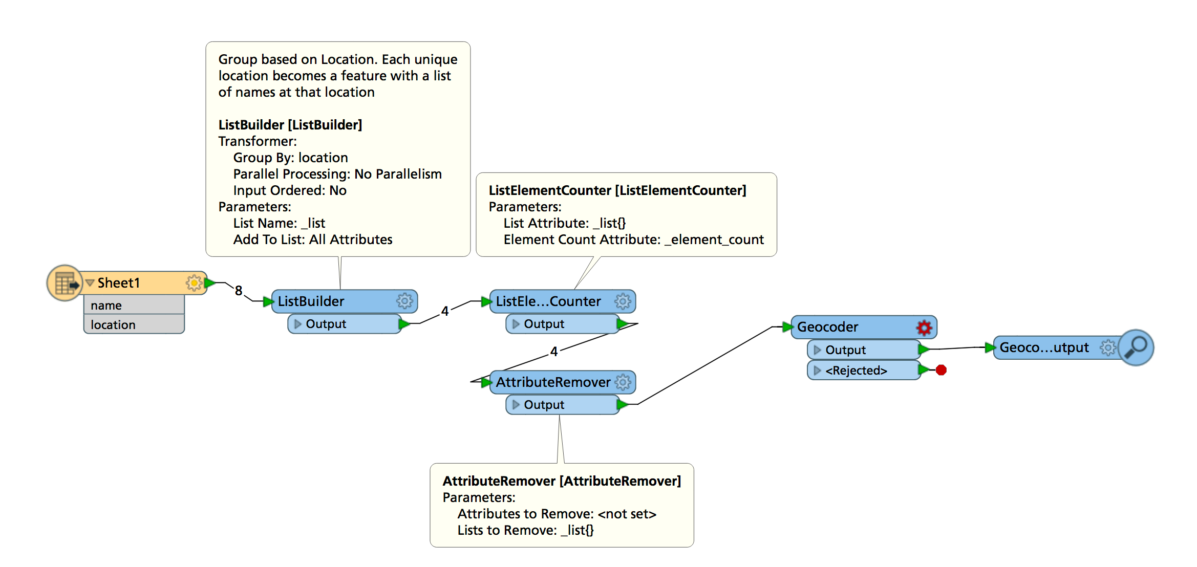
I have an ESRI Feature Class with 4000 records, of staff and the location they are each based at, in a field "Location." So for arguments sake, there are 50 different locations. What I would like to do is symbolise in ArcMap using proportional symbols the number of staff at each location. Is there a way in FME that I can set up the Feature Class to enable me to do this ? So for example, say of the 4000 staff records there are 1000 based in London (simply populated "London" in the "Location" field) then I wish to then symbolise this proportionally (based on that 100 figure), and likewise for other cities too.

Thanks


Do you have geometry for each location? E.g. You know where to create the proportional symbols.


Or do you need to find the location of each location e.g. London is at 51.507222,-0.1275 using a geocoder?

I think this would do the trick:

Note I haven't set up the Geocoder, that's why it's red. There's various different geocoding services you can access through the Geocoder. If you have an ESRI ArcGIS Online account you can use that one, I personally use the OpenCage one, it has a decent number of "free" lookups.

One comment about the locations: if they're just the names of cities it might be difficult for a geocoder service to come up with the right one. Any additional information you have on those (country, state/province/county) will greatly improve the geocoding results.

And to elaborate: the actual visualisation would be done in ArcMap. The ListElementCounter gives you an attribute with the number of people at each location.


Reply