
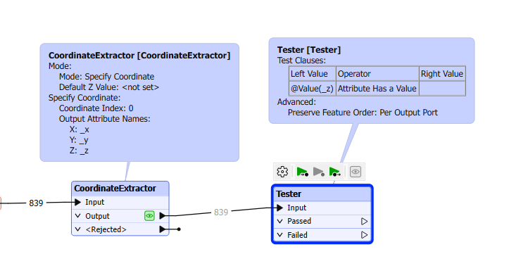
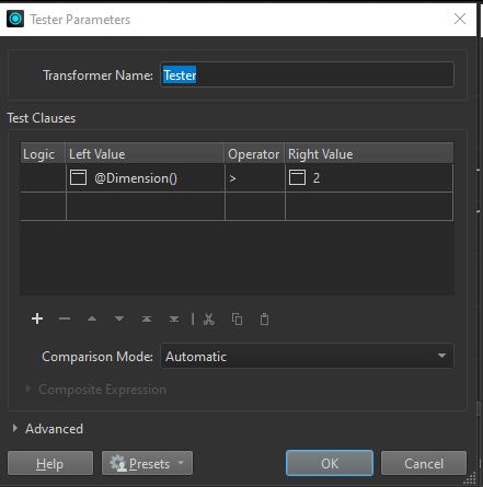
What would be the best way (aside from opening the file in a GIS software) to find out if the vertices in a shapefile has a Z and/or an M?

Hi @regie_alam 


I suggest you to use the transformer to identify the coordinates x,y and z - CoordinateExtractor.


And after to filter the Z values:


For measures I don't know. Still figuring out how it works.


Alternative approach to @danilo_fme and @jkr_wrk excellent suggestions:

You can use the DimensionExtractor transformer to extract the dimension of features (either 2 or 3) to an attribute and then test for that. Then a MeasureExtractor can be used to extract measures. If there are no measures present it will reject those features.


I tried the MeasureExtractor and indeed it rejected my features. But didn't know if it was because it hadn't any or that I didn't search for the right name.

As for dimensions, don't want to brag, but my solution does not require extracting and removing an attribute. Someone at @redgeographics pointed me to that.


Reply