
I have a jpg of a historical map (with no accompanying data) that I'm trying to write data for to upload into google maps as a KML file. I know the coordinates of the map, so I started with the RasterGeoreferencer to assign the correct coordinates. 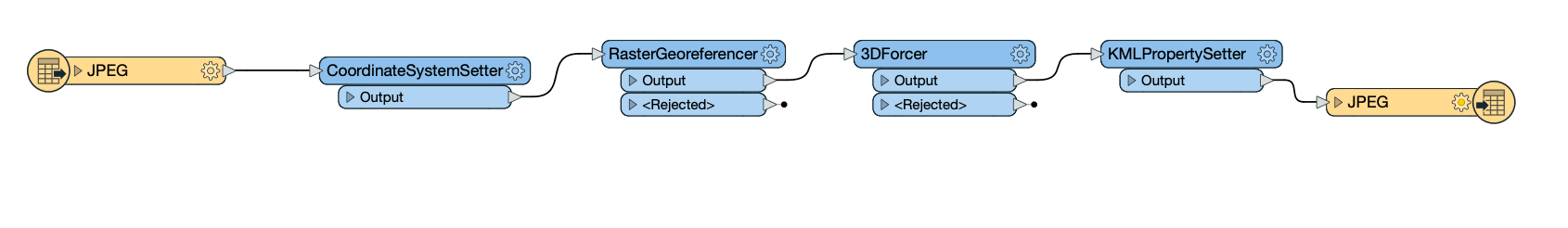 The problem is that none of the data that I want to create/ add to the file (for example, a z coordinate with the 3d forcer) shows up. There is a coordinate system assigned, and I can find the coordinates of any point I click on in the graphics window, but the data doesn't seem to be stored in any category.
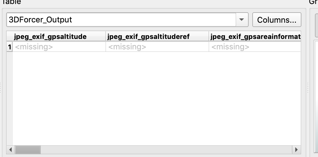
This returns missing data for everything except for the source name...
How would I properly write data for my map so that I can turn it into a workable KML file?