Hi all
I've created a WMS service that streams GeoJSON as the response for the GetFeatureInfo operation. At first I was creating the JSON using the JsonTemplater connected to a Text File writer. When I tested the workspace the result displayed directly in the web browser. Problem was I had some formatting issues in the returned JSON that I'd have to deal with.
I realized that if I switched to a GeoJSON writer the formatting would be handled for me. This works great but when I test via a web browser I get a file download instead of the a direct display of the returned data in the browser.
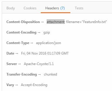
I think it's caused by the Content-Disposition header in the request response.
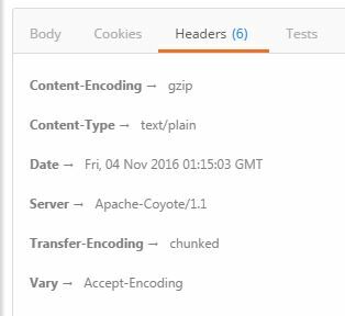
This is the response when using the Text File writer:

And this is the response when using the GeoJSON writer:

Is there any way to remove the Content-Disposition header when streaming from a GeoJSON writer?
Update:
I've used the JSONTemplater to create a return JSON with the same structure as the GeoJSON would have (see attached workspace - the disabled portion is the work-around). Although this works fine, it'd be much simpler to just write out to GeoJSON and to avoid all the formatting.
@RylanAtSafe - Here is the info you requested
Browser: Google Chrome 54.0.2840.71 m
FME Desktop 2016.1.0.0 (20160419 - Build 16492 - WIN32)
FME Server 2016.1.0.1 - Build 16494 - linux-x64
Workspace attached
For now all we want to do is return the attribute values in a custom web application when the user clicks or hovers over a location on the map but may wish to display to use the geometries in the future.


