Hi @curtisd54 ,
Sorry, not clear what your requirement is. Could you please elaborate what you would like to achieve more specifically?
It would be helpful to understand your question if you could share a minimal dataset and explain your disired result which should be generated based on the dataset.
thanks for the response @Takashi . Below is what I am trying to accomplish:
I have
table A :
where I have split the data using field 'Source_Name' and a specific name in the fields results , into North and South
Table B:
has different data, similar, but no same fields etc to match up. But it is the same AREA as table A
I want to split table B based on the same location(AREA) that was used to split Table A
I am looking for the best way to accomplish this?
I think you are attempting to transfer an attribute storing "North" or "South" from A feature to a B feature which is spatially equal to the A feature. If I understood your requirement correctly, SpatialFilter might help you.
Send the A features to the Filter port, send the B features to the Candidate port, and set "Filter OGC Equrals to Candidate" to the Spatial Predicates to Test paramter. The SpatialFilter will output B features from the Passed port, each of them will have attributes transfered from spatially related A feature.
However, if a B area doesn't exactly match a relevant A area, "Equals" test won't work. In such a case, the solution would be different depending on the spatial reletionshipts among the A areas - i.e. disjoint each other, touching each other, or overlapping each other.
If the SpatialFiler with "Eauals" test couldn't work, could you please share a screenshot illustrating spatial relationships among the A areas?
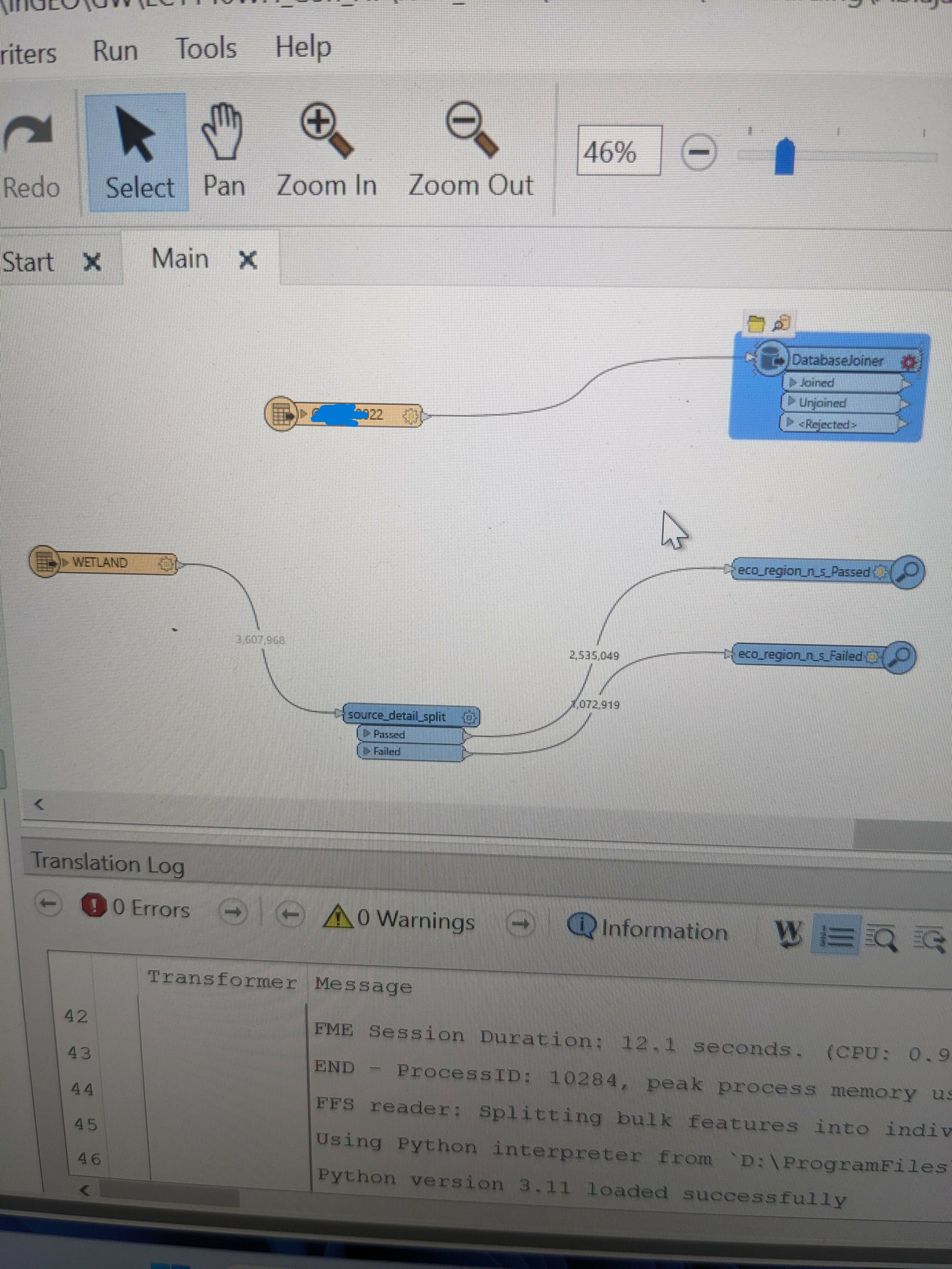
This doesnt quite work . I have attached a couple screenshots of what I am trying to accomplish and my data
this is using the tester to split the data in 2 (based on the parameters shown in the image below) .
But I want to do the same for the FGDB - '22' at the top of the image based on the results of the tester
For example: could I add a new field from the tester results (Ie. N or S) and then join that field with the FGDB table "22" at the top ? then use another tester to split that data based on the new field ?
@Takashi Iijima let me know if you can help me with this issue ?