I need to merge individual 1km2 LIDAR tiles in .asc format to form a single layer.
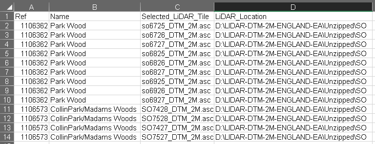
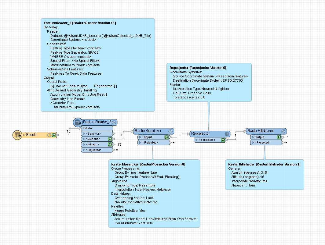
I have a table (.xlsx) which lists the .asc files, their folder location and the site reference they are associated to. I have read the table into FME and using a FeatureReader and can open all the .asc files and by using the RasterMosaicker, and Reprojector I can combine the the .asc files and output the merged LiDAR.
This works fine for a single site. Of course when I add further sites to the table I end up with all the LiDAR merged into a single feature.
How can I set up FME to iterate through the table merging the necessary tiles and produce a single LiDAR output before repeating the process for the remaining sites?


