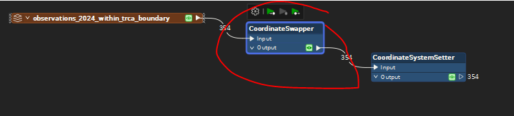
Has anyone run into an using the OGC WFS Reader for a WFS hosted by QGIS Server where the coords are swapped? Before I go back to the provider with the observation “hey I think there’s a bug in how your service is being delivered” I’d like to check that it’s not a known issue etc. To use the service I had to do the following:
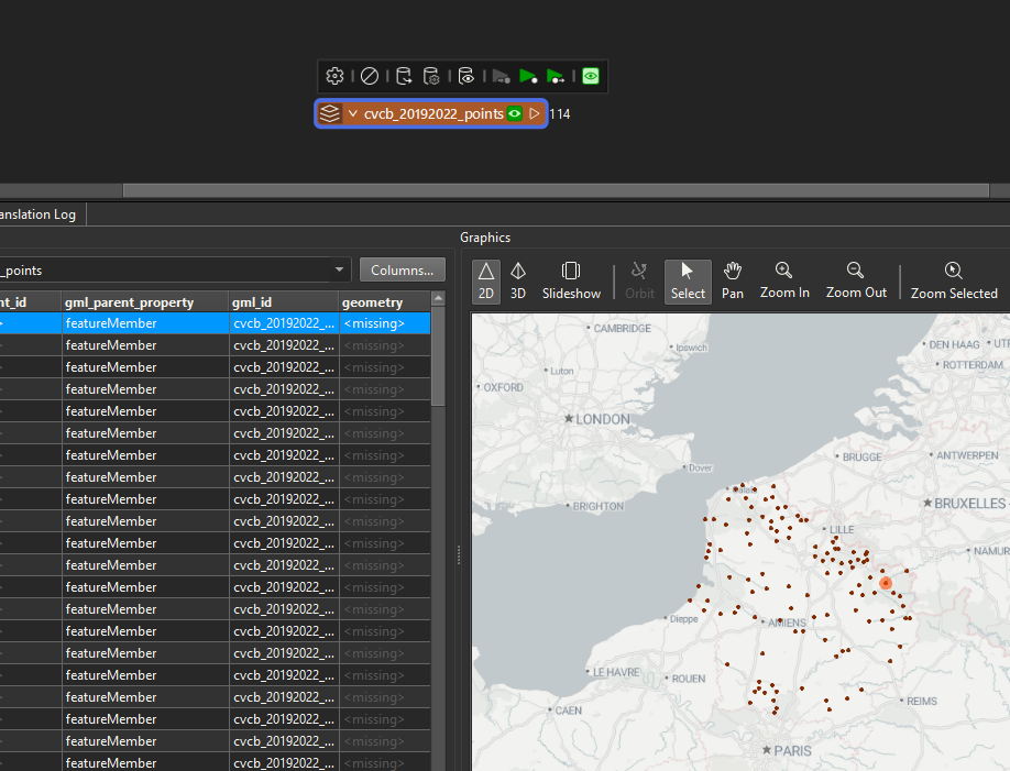
I was able to successfully read in this service using the OGC WFS Reader using FME 2025.0 (see image below) -- no issues with the coordinates.
Have you tried reading the WFS with another application other than FME? What version of FME are you using?
This post is closed to further activity.
It may be an old question, an answered question, an implemented idea, or a notification-only post.
Please check post dates before relying on any information in a question or answer.
For follow-up or related questions, please post a new question or idea.
If there is a genuine update to be made, please contact us and request that the post is reopened.
@nampreetatsafe Thanks for confirming Nampreet. My suspicion is the service. I am using 2024.0 and have never ran into an issue before. Wanted to see if anyone had experienced something like this before.


")
