




Question

Voxel from 3D points (in netCDF format)

  • Oct 27, 2026 12:14 AM UTC
  • 3 replies
  • 69 views

riplizard
Contributor
Forum|alt.badge.img+2

I have 3D points (XYZ), with some attributes. The points have fixed distances; Z: 0.5m, X: 50m, Y: 20m. There's a "stack" of 200 points at each location. I want to convert these points into voxels, with a dimension of 0.5m*50m*20m (ZXY) per voxel. The output format must be netCDF.

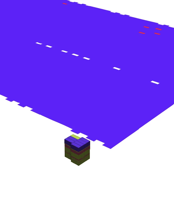
However, I can't get it to work. I managed to write a file ArcGIS Pro recognizes as voxel layer, but nothing is visible. Another attempt is recognized as multidimensional data (in 2D) only. In both cases I used NumericRasterizer, and the netCDF writer seems to accept only raster data. Can it write voxel data, and if, how? Below are some screenshots for clarification.


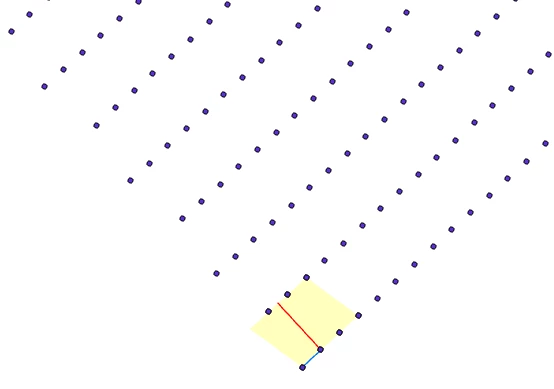
Points in 2D - the blue line is 20m; red is 50m (perpendicular to the rows); the pale yellow area is what I’m using for my tests (the dataset has about 1.8m points in total)
 

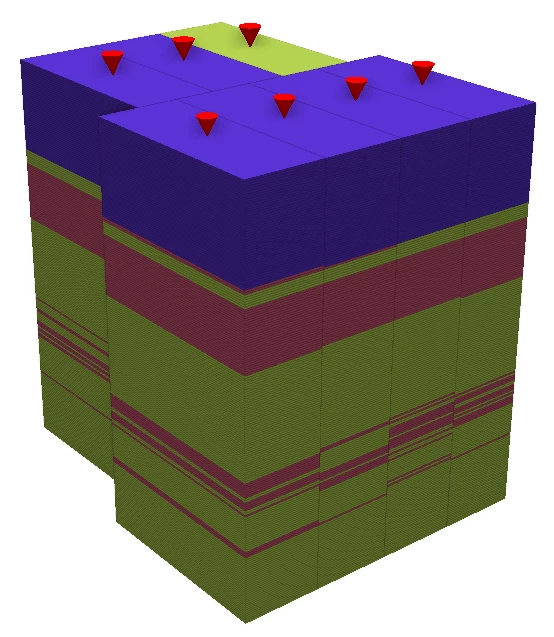
Points in 3D


Mockup with point symbology - desired result
 

2D netCDF
 

3 replies

evieatsafe
Safer
Forum|alt.badge.img+28
  • Safer
  • Nov 2, 2026 7:32 PM UTC

Hi ​@riplizard, thanks for your question! I know that Voxel Geometry has been deprecated in FME 2026.1. It also looks like these are actually point clouds, as you mention 3D points (XYZ), so we may need a bit more information before we can fully answer.

  • Could you confirm which version of FME you are using?
  • Where are your 3D points (XYZ) coming from? (source application)
  • Could you provide a sample of your data as well as your workspace? You can share this as a template workspace (fmwt), including your data cache, so you can share both at the same time. Please zip it before uploading it as an attachment to the community.

This will help us investigate and help you more effectively. Let us know if you have any other questions!


riplizard
Contributor
Forum|alt.badge.img+2
  • Author
  • Contributor
  • Nov 5, 2026 12:09 PM UTC

Hi ​@evieatsafe, thanks for the reply. It was a bit urgent, so I already solved it with netCDF4.


The version is FME(R) 2026.1.0.0 (20260311 - Build 26103 - WIN64) 

The source was originally in a gpkg, which I imported into a gdb (point layer with Z). I used a plain csv (coordinates and attributes) for my conversion, though.

Basically what I expected was an option in the writer to set the voxel’s XYZ dimensions, since that was really all the extra input that would be required.


evieatsafe
Safer
Forum|alt.badge.img+28
  • Safer
  • Nov 12, 2026 9:20 PM UTC

Hi ​@riplizard, thanks for the extra info, and I’m glad you were able to have a workaround in the meantime. 
I have attached a workspace showing how to go from a point cloud (xyz) to NetCDF while preserving the Z values in a multi-band raster. The idea is to rasterize the values to a band, instead of 3d point locations. Ultimately, we save the ‘z’ value as the band value, rather than spatially.

I want to clarify and comment on some of your comments above as well:

  • “the netCDF writer seems to accept only raster data.” This is correct, since NetCDF is a raster-based format. Documentation for reference.
  • Have you tried going straight from gpkg to netCDF? The conversion you have of gpkg>gdb>csv>netCDF (if I understand correctly) seems cumbersome. Are you gaining extra information from each conversion this way?

If you would like further support, please submit a ticket so our team can look into this further. We would be happy to help look into it with you! When submitting your ticket, please provide:

  • The workspace (or sample workspace) that you have started with.
  • Any required data, e.g. your gpkg.

Happy FMEing!