Hi @abal,
Â
Thanks for your question! I'm not too familiar with all the SNAP tools, but perhaps I can help you find out if FME can get at the data/metadata you need. To start, can you give a bit more detail as to what's missing using the GeoTIFF reader? Is there some documentation from Sentinel that outlines the needed metadata for your SNAP corrections?
Â
Looking forward to learning more about this!
Â
Â
Best,
Nathan
I had much better luck using SNAP with the sentinel 2 data from the copernicus hub then from AWS.
Yes, unfortunately, I am facing the same problem.
Â
Â
Hi @abal,
Â
Thanks for your question! I'm not too familiar with all the SNAP tools, but perhaps I can help you find out if FME can get at the data/metadata you need. To start, can you give a bit more detail as to what's missing using the GeoTIFF reader? Is there some documentation from Sentinel that outlines the needed metadata for your SNAP corrections?
Â
Looking forward to learning more about this!
Â
Â
Best,
Nathan
Â
Hi Nathan,
Â
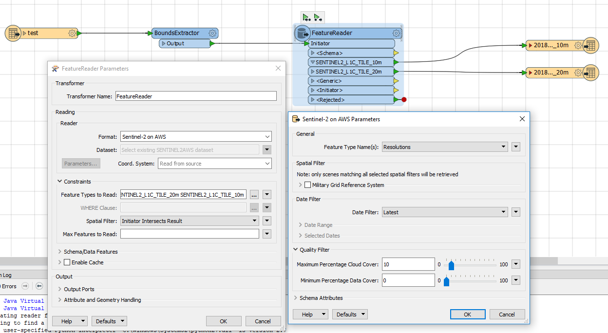
Thanks for your help. I have the following set up in FME Desktop 2018.0.0.1 - Build 18295 - WIN64.
The specification of the input data can be found at n1]. The manual for the sen2cor ( Sentinel 2
(atmospheric) Correction) is stored at e2]. My aim is to generate Level 2A products of Sentinel images which includes an transformation from top-of-atmosphere radiance (Level 1C product) to bottom-of-atmosphere reflectance. Therefore I want to use the sen2cor plug-in within SNAP as long as this functionality is not yet provided by FME (maybe excluding using a python script). I think comparing the metadata from Sentinel images from Copernicus Hub could be a good start.
Â
Additionally, you can see that I filtered the Sentinel data by resolution.The 10 meter bands are ordered as follows:
Â
GeoTIFF_band1: Red16 (Sentinel_band4)
Â
GeoTIFF_band2: Green16 (Sentinel_band3)
Â
GeoTIFF_band3: Blue16 (Sentinel_band2)
Â
GeoTIFF_band4: UINT16 (Sentinel_band8)
Â
This is, IMO, very confusing for users which are used to RS software. To generate a CIR image, it is now necessary to set the band order to 4-1-2 instead of the the more intuitive way of band combination 4-3-2 in other RGBI images (for example RapidEye, Landsat7, etc.).
Â
Â
I am exited to hear from you!
Â
Cheers,
Â
André
Â
Â
©1]
http://step.esa.int/thirdparties/sen2cor/2.5.5/docs/S2-PDGS-MPC-L2A-IODD-V2.5.5.pdfÂ
52] http://step.esa.int/thirdparties/sen2cor/2.5.5/docs/S2-PDGS-MPC-L2A-SUM-V2.5.5_V2.pdf
Yes, unfortunately, I am facing the same problem.
Â
Â
What I did was use FME to automatically download the files, unpack them and then run sen2cor via the command line.
Â
Â
I used the Open Access API to determine which files,
https://scihub.copernicus.eu/userguide/6OpenSearchAPI via the HTTPCaller.
Â
Â
Processed the resulting data, to filter the files I actually wanted, used the HTTPCaller again to download the files.
Â
Â
and then PythonCaller to run sen2cor, though I suppose you could use the systemCaller.
Â
Â
I recall that I had to create a couple of environmental variables to get sen2cor to run on the commandline, but I don't remember the exact details.
Â
Â