Solved

ESRI Reprojector

  • November 30, 2019
  • 33 replies
  • 239 views

Forum|alt.badge.img

Hello, I am using FME Workbench 2019.2, ESRI Reprojector does not support the custom geographic parameters of ArcMap 10.7. I used the 2018 version to see the geographic parameters. Why ca n’t I recognize them after updating?
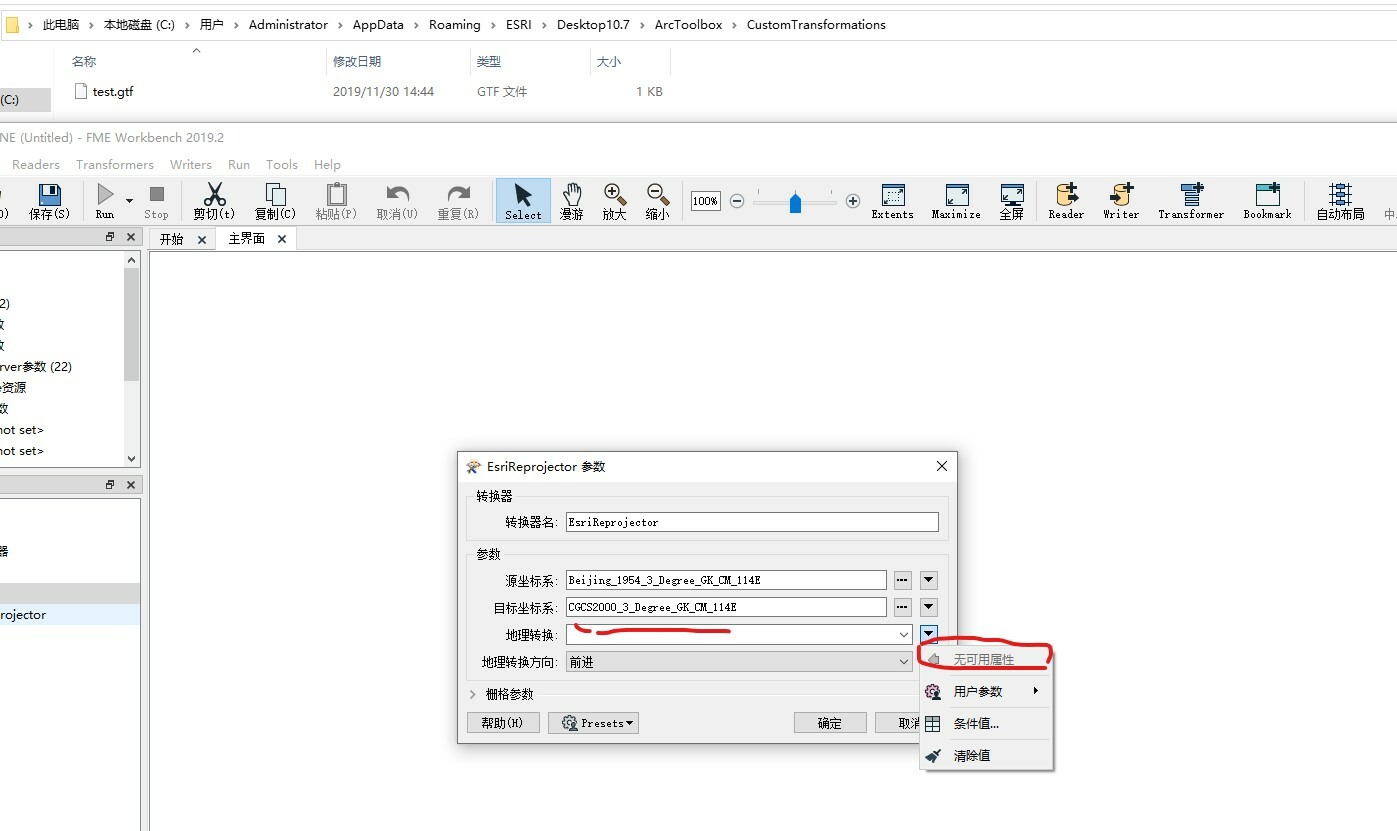
Best answer by andreaatsafe

Hi all,

I'm please to let you know that this issue has been resolved in the latest FME 2020.1 beta. You can find the latest beta to download here.

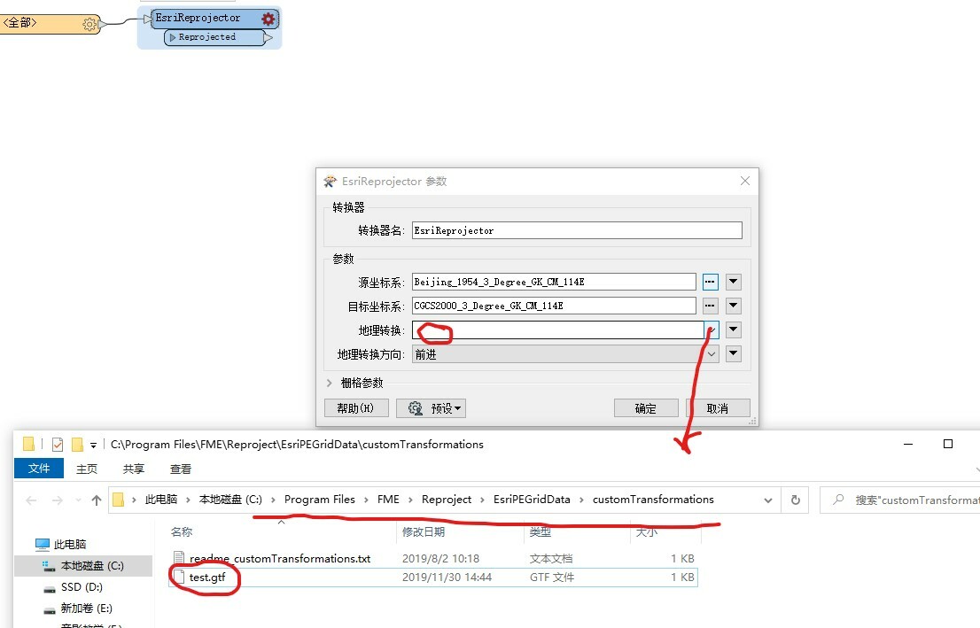
On any of FME's supported operating systems, you can place the custom transformation *.gtf file in the following folder to select the transformation:

<FME_Install>\Reproject\EsriPEGridData\customTransformation

After putting the file in the appropriate folder, you will be able to select this transformation in the EsriReprojector.

Edit: If you have ArcGIS installed on the same machine you are using FME (aka on a Windows machine), then FME will also look in the users appdata folder (Windows only) inside one of several ArcGIS specific folders (eg. 

%appdata%/Esri/ArcGISPro/ArcToolbox/CustomTransformations
 or 
%appdata%/Esri/Desktop10.8/ArcToolbox/CustomTransformations
). So it may not be necessary to place the *.gtf file in the FME installation directory if you have ArcGIS installed on your machine.

- Andrea

This post is closed to further activity.
It may be an old question, an answered question, an implemented idea, or a notification-only post.
Please check post dates before relying on any information in a question or answer.
For follow-up or related questions, please post a new question or idea.
If there is a genuine update to be made, please contact us and request that the post is reopened.

33 replies

lars_de_vries
Forum|alt.badge.img+10

Your transformer has no input. Because there is no input, it is not possible to select an attribute. It would be a nice addition if it would be possible to select the Text Editor here. You could create an idea for that.

I think that it is possible to use the Text Editor if you create a Conditional Value. You could refer to a non existent property to match, to make sure it uses that result.


Forum|alt.badge.img
  • Author
  • December 4, 2019

Hello, I am very glad to receive your reply. This ESRI Reprojector should be able to read the file defined by arcgis (screenshot at the address above), but it has not read the file. It can be read normally before the 2018 version. , This path information cannot be read after upgrading


lars_de_vries
Forum|alt.badge.img+10

Hello, I am very glad to receive your reply. This ESRI Reprojector should be able to read the file defined by arcgis (screenshot at the address above), but it has not read the file. It can be read normally before the 2018 version. , This path information cannot be read after upgrading

To get the Esri dropdown list, you should use the dropdowen button left of the own you selected in the screenshot. That will show the Esri options.


Forum|alt.badge.img
  • Author
  • December 6, 2019

Hello, I am very glad to receive your reply. This ESRI Reprojector should be able to read the file defined by arcgis (screenshot at the address above), but it has not read the file. It can be read normally before the 2018 version. , This path information cannot be read after upgrading

Hello, glad to receive your reply, the drop-down inside the left side of the button is empty, and the definition file of esri is not recognized


andreaatsafe
Safer
Forum|alt.badge.img+15

Hi @jactry,

With FME 2019 and newer, the EsriReprojector is now packaged within FME and does not require Esri products to be installed.

With this change, for custom transformations, you will need to put a copy of the custom grid transformation in the following folder: 

<FME Install Directory>\Reproject\EsriPEGridData\customTransformations

Custom geographic transformations of type '.gtf' can be stored in the folder and the EsriReprojector will be able to detect stored geotransformations.

- Andrea


Forum|alt.badge.img
  • Author
  • December 8, 2019

Hi @jactry,

With FME 2019 and newer, the EsriReprojector is now packaged within FME and does not require Esri products to be installed.

With this change, for custom transformations, you will need to put a copy of the custom grid transformation in the following folder: 

<FME Install Directory>\Reproject\EsriPEGridData\customTransformations

Custom geographic transformations of type '.gtf' can be stored in the folder and the EsriReprojector will be able to detect stored geotransformations.

- Andrea

Hello, thank you very much for your reply. I always thought that FME is a 64-bit version installed, and it matches the esri arcigs version. Now I will test it as you said!


Forum|alt.badge.img
  • Author
  • December 8, 2019

Hi @jactry,

With FME 2019 and newer, the EsriReprojector is now packaged within FME and does not require Esri products to be installed.

With this change, for custom transformations, you will need to put a copy of the custom grid transformation in the following folder: 

<FME Install Directory>\Reproject\EsriPEGridData\customTransformations

Custom geographic transformations of type '.gtf' can be stored in the folder and the EsriReprojector will be able to detect stored geotransformations.

- Andrea

0684Q00000ArMNqQAN.jpg

Hello, now I test as you said, I still can't hit the custom grid parameters of this drop-down menu


andreaatsafe
Safer
Forum|alt.badge.img+15

Hello, now I test as you said, I still can't hit the custom grid parameters of this drop-down menu

Hi @jactry,

Is this the same file that you are using for the transformation in ArcGIS?

Are you able to attach a sample workspace and the GTF you are using?

- Andrea


Forum|alt.badge.img
  • Author
  • December 11, 2019

Hi @jactry,

Is this the same file that you are using for the transformation in ArcGIS?

Are you able to attach a sample workspace and the GTF you are using?

- Andrea

acad2acad.fmw acad2acad?2?.fmwBecause the website cannot upload gtf, you must change the acad2acad (2) .fmw extension to rar to open


andreaatsafe
Safer
Forum|alt.badge.img+15

acad2acad.fmw acad2acad?2?.fmwBecause the website cannot upload gtf, you must change the acad2acad (2) .fmw extension to rar to open

Hi @jactry,

Unfortunately, the attachments cannot be downloaded.

Could you zip the FMW and the GTF file into one ZIP file and try attaching again?

- Andrea


Forum|alt.badge.img
  • Author
  • December 17, 2019

Hi @jactry,

Unfortunately, the attachments cannot be downloaded.

Could you zip the FMW and the GTF file into one ZIP file and try attaching again?

- Andrea

bj54-2000.zip


  • Have you solved your problem? I have the same problem.


??????????????????

Translation from Google Translate: I have this problem too. How do you solve it?


Forum|alt.badge.img
  • Author
  • December 26, 2019

??????????????????

Translation from Google Translate: I have this problem too. How do you solve it?


?????? ???????bug


?????? ???????bug

????????????

Google Translate: Can I only switch back to the lower version?


Forum|alt.badge.img
  • Author
  • December 26, 2019

Hi @jactry,

Unfortunately, the attachments cannot be downloaded.

Could you zip the FMW and the GTF file into one ZIP file and try attaching again?

- Andrea

What's the problem? Whether to find the problem and solution


Forum|alt.badge.img
  • Author
  • December 26, 2019

????????????

Google Translate: Can I only switch back to the lower version?

There is no reply yet, if you use this converter, you may need to lower the version number


chrisatsafe
Contributor
Forum|alt.badge.img+2
  • Contributor
  • December 30, 2019

What's the problem? Whether to find the problem and solution

Hi @jactry and @hrc495394678,

Thank you for providing the gtf file. This is an interesting one... do you have the Windows UTF-8 beta setting enabled?

You can confirm by going to: Settings > Time & Language > Language > Administrative Language Settings > Change System Locale > Enable Unicode UTF-8 Beta check box. Does this work if you enable/disable it?


The issue you reported appears to be similar to this post - we are going to take a closer look into as it might be a bug.


Forum|alt.badge.img
  • Author
  • December 31, 2019

Hi @jactry and @hrc495394678,

Thank you for providing the gtf file. This is an interesting one... do you have the Windows UTF-8 beta setting enabled?

You can confirm by going to: Settings > Time & Language > Language > Administrative Language Settings > Change System Locale > Enable Unicode UTF-8 Beta check box. Does this work if you enable/disable it?


The issue you reported appears to be similar to this post - we are going to take a closer look into as it might be a bug.

Hello, I am very glad to receive your reply. Whether the Enable Unicode UTF-8 Beta check box is enabled or disabled, the custom file tgf generated by arcgis is ANSI.


mark2atsafe
Safer
Forum|alt.badge.img+59
  • Safer
  • January 6, 2020

Hello @jactry - it appears that you clicked the "Ask an Expert" button multiple times. Can you please not do that, because it causes many emails to be sent to many people. Please just click that button a maximum of one time. If you don't get a response and still need assistance, then I suggest that you contact your local FME partner's support team, or the support team at Safe (safe.com/support). Thank you for your understanding.


andreaatsafe
Safer
Forum|alt.badge.img+15

Hello, I am very glad to receive your reply. Whether the Enable Unicode UTF-8 Beta check box is enabled or disabled, the custom file tgf generated by arcgis is ANSI.

Hi @jactry,

Thanks for letting us know.


We have filed a ticket for our development team to look into this.

- Andrea


Forum|alt.badge.img
  • Author
  • April 17, 2020

Hi @jactry,

Thanks for letting us know.


We have filed a ticket for our development team to look into this.

- Andrea

HI, does this question already have results?


You can try to copy paste the name of the transformation file like "test1"


Hello, I am very glad to receive your reply. This ESRI Reprojector should be able to read the file defined by arcgis (screenshot at the address above), but it has not read the file. It can be read normally before the 2018 version. , This path information cannot be read after upgrading

same problem for me too, i have esri 10.6 and fme 2020. Dropdown menu doesnt recognize the custom transformation file that i put on that directory.


Forum|alt.badge.img

Still no resolution?