



Hi everyone,
I'm working on an FME automation to update existing telecom conduit geometries using surveyed locator points.
Current workflow:
-
Surveyed locator points are provided in a CSV file containing latitude, longitude, and Record Index.
-
I use VertexCreator and LineBuilder to create a surveyed line based on the Record Index.
-
Existing conduit geometries are retrieved from an API.
-
I'm using SpatialFilter and AnchoredSnapper to identify nearby conduits and adjust their geometry to follow the surveyed line.
The challenge:
The surveyed points may follow a single conduit or multiple connected conduits. The CSV does not contain conduit IDs, so the automation needs to determine which existing conduit geometries should be updated.
There may also be connecting conduits near the surveyed route. When the main conduit geometry is adjusted, the endpoints of connecting conduits need to move accordingly to maintain network connectivity.
For example, in one test case, two connected conduits need to follow the surveyed line, while a third connecting conduit should retain its original shape except for its shared endpoint.
Expected result:
-
Dynamically identify the conduit or conduits corresponding to the surveyed locator points.
-
Adjust their geometry to follow the surveyed line.
-
Preserve unaffected portions of existing geometries.
-
Update connecting conduit endpoints to maintain connectivity.
-
Support different conduit configurations without hardcoding IDs or requiring manual intervention.
I've been able to achieve the expected geometry for a specific test case using AnchoredSnapper and endpoint adjustments, but I'm struggling to make the conduit selection fully dynamic.
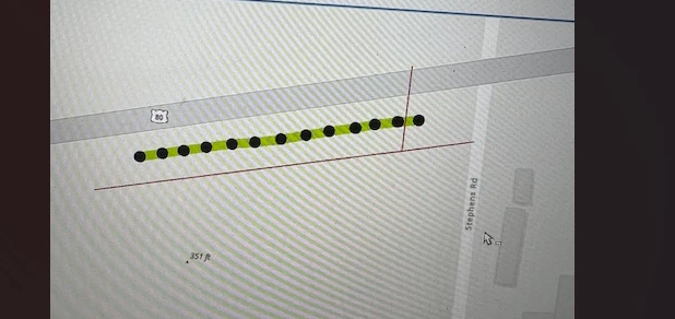
Has anyone implemented something similar in FME? I'd appreciate suggestions on transformers, network-based approaches, or workflows for matching a surveyed line to multiple connected existing line features. I’ve attached a screenshot of an example i am working. black points are locator data the green line i created a line using locator data. the lines along the points that needs to be snapped to the surveyed line.
Thanks in advance!