Question

WMS to Shapefile conversion

  • April 12, 2018
  • 6 replies
  • 410 views

Hi i downloaded FME Trail version and using Workbench. And I am trying to convert WMS "link" to shapefile format.

It is reading well but, while writing into shapefile it is throwing error. See the below error information

"A fatal error has occurred. Check the logfile above for details

FME Session Duration: 2.8 seconds. (CPU: 0.2s user, 0.1s system)

END - ProcessID: 4020, peak process memory usage: 40856 kB, current process memory usage: 39564 kB

A fatal error has occurred. Check the logfile above for details

Program Terminating

Translation FAILED."

Please help me regarding this issue.

@vamsi krishna

This post is closed to further activity.
It may be an old question, an answered question, an implemented idea, or a notification-only post.
Please check post dates before relying on any information in a question or answer.
For follow-up or related questions, please post a new question or idea.
If there is a genuine update to be made, please contact us and request that the post is reopened.

6 replies

danilo_fme
Celebrity
Forum|alt.badge.img+51
  • Celebrity
  • 2077 replies
  • April 12, 2018

Hi @vamsi,

Could you send the link to test?

Thanks,

Danilo


david_r
Celebrity
  • 8394 replies
  • April 12, 2018

Normally, a WMS returns a raster, but shapefiles don't support rasters.

Can you perhaps explain your requirement in more detail?


  • Author
  • 1 reply
  • April 13, 2018

Hi Danilo,

I am trying get shapefiles from WMS and WFS links. Datasets reading from the respective links, while writing into shapefile or geodb format it is throwing error or some times no entitties writing in the shapefile. Here i am attaching the link below.

https://geoportaal.fryslan.nl/arcgis/services/ProvinciaalGeoRegister/PGR2/MapServer/WMSServer?request=GetCapabilities&service;=WMS

https://geoportaal.fryslan.nl/arcgis/services/ProvinciaalGeoRegister/PGR2_features/GeoDataServer/WFSServer?request=GetCapabilities&service;=WFS


danilo_fme
Celebrity
Forum|alt.badge.img+51
  • Celebrity
  • 2077 replies
  • April 13, 2018

Hi Danilo,

I am trying get shapefiles from WMS and WFS links. Datasets reading from the respective links, while writing into shapefile or geodb format it is throwing error or some times no entitties writing in the shapefile. Here i am attaching the link below.

https://geoportaal.fryslan.nl/arcgis/services/ProvinciaalGeoRegister/PGR2/MapServer/WMSServer?request=GetCapabilities&service;=WMS

https://geoportaal.fryslan.nl/arcgis/services/ProvinciaalGeoRegister/PGR2_features/GeoDataServer/WFSServer?request=GetCapabilities&service;=WFS

Hi @vamsi


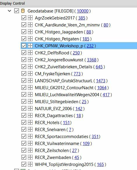
First I created a Workspace to read the WFS and Write in Geodatabase.


Some layers from WFS doens't has features. Geodatabase layers:


Attached the Workspace - workspace-wfs.fmwt


I'm checking now the WMS.


Thanks,


Danilo


danilo_fme
Celebrity
Forum|alt.badge.img+51
  • Celebrity
  • 2077 replies
  • April 15, 2018

Hi @vamsi,

Did you check the workspace with WFS format that I attached?

Thanks,

Danilo


lars_de_vries
Forum|alt.badge.img+10

Hi @vamsi,

You are trying to read from a ArcGIS Server. You can also use the ArcGIS Server Feature Service reader and adjust the URL to

https://geoportaal.fryslan.nl/arcgis/rest/services/ProvinciaalGeoRegister/PGR2/MapServer/

I guess you won't have a problem writing to Shapefile then.