

Question

Why does ArcGIS read the wrong projection after using EsriReprojector?

  • March 28, 2017
  • 1 reply
  • 36 views

Forum|alt.badge.img

I am trying to reproject an ECW image from EPSG:31467 to EPSG:25832 with FME 2017. After reprojecting using either "Reprojector" or the "EsriReprojector" the output coordinate system is always NUTM32 even though I specifically assigned "ETRS_1989_UTM_Zone_32N". The Coordinates are also totally wrong lying 3000km east of where they should be. Can anyone explain what I am doing wrong?
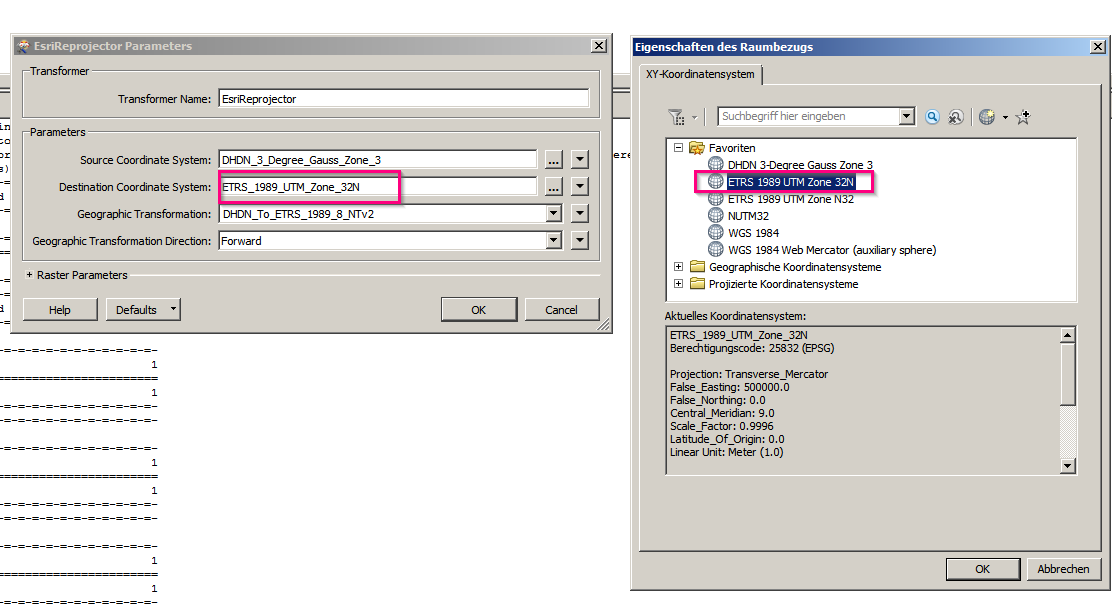
This is then not

This post is closed to further activity.
It may be an old question, an answered question, an implemented idea, or a notification-only post.
Please check post dates before relying on any information in a question or answer.
For follow-up or related questions, please post a new question or idea.
If there is a genuine update to be made, please contact us and request that the post is reopened.

1 reply

  • April 20, 2017
If you have anything in the Coordinate System parameter of the writer it will reproject to that upon writing, after the reprojector transformer(s). Make sure it is blank and it will take the CRS of the input data or whatever the transformer sets.