Question

Vertical coordinate system

  • April 3, 2024
  • 1 reply
  • 52 views

787d
Contributor
Forum|alt.badge.img

Hello,
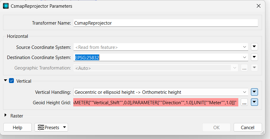
I am trying to transform a point cloud with ellipsoidal heights into orthomethic heights (DHHN2016) using the CsmapReprojector. The settings can be seen in the image. For the Geoid Height Grid I need a file in .gdc format. My target system is DHHN2016, for which I have the quasigeoid in various file formats (e.g. JPG, TIFF, GEM, TXT, GSF, GFF, GGF) but not in .gdc.


Is there a website from which I can download the appropriate format or another way?
Thank you very much.

Translated with DeepL.com (free version)

1 reply

james_c_452
Supporter
Forum|alt.badge.img+7
  • Supporter
  • April 15, 2024

Hi there, this reply won’t be helpful to you but it might be to someone else. What I have found works in the past in this case is to use the point cloud on raster setter to set the geoid z value


Cookie policy

We use cookies to enhance and personalize your experience. If you accept you agree to our full cookie policy. Learn more about our cookies.

 
Cookie settings