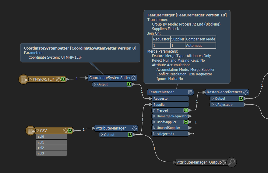
I am trying to build a workbench based on Dimitri's rooftop building smart recognition workbench.
My first step is to use a decent resolution raster file from my GIS software I use. Problem is, it is not georeferenced, but does have a text file with the extension RCT or raster coordinate text. It does not have column names, but I was able to use, with and expert's help, a CSV reader, since it is always space delimited as X left, Y bottom, X right, Y top. But I am getting an error that the @GeoreferenceRaster is failingon the first attribute coordinate, X Upper Left. I have attached a copy of the workbench, PNG file, and RCT coordinate text file. Please note that the raster has an extension of JPG, but is really a PNG.


