I'm breaking my Roadway center line into each Vertex and when I use a spatial filter I'm unable to get 100% match. Any help?


I'm planning to use line builder to create each line between each Vertex and remove the fake lines as some roadways have "multipart poly lines" ..Where m = two GPS locations. I hope to spatial filter those out.
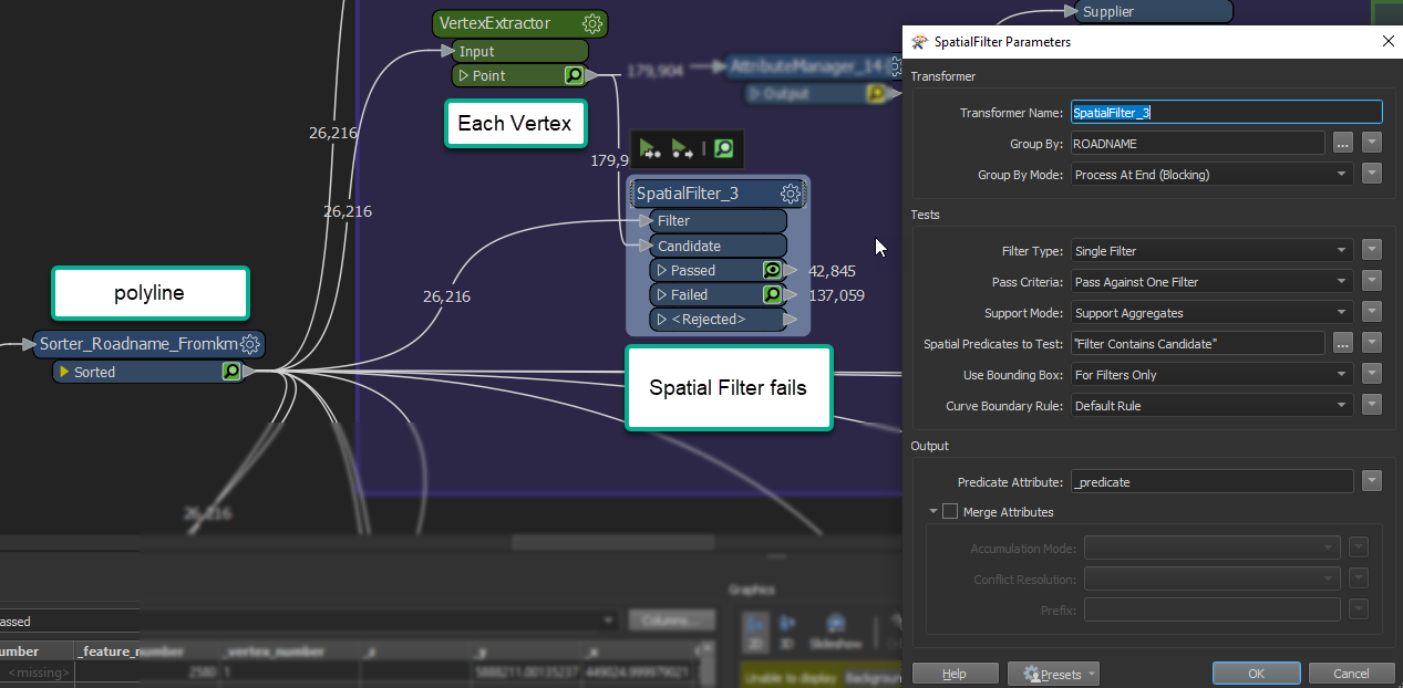
 

polyline, Vertex Extractor and Spatial filterThis is the start of my work space, and I cannot get 100% match? Same GPS coords, I looked at the GPS value 7 decimals down and they match.


449024.999979021

Hi @trevorm, have you try to buffer the points by 0.1 or 0.2?


Hi @trevorm There's no tolerance parameter on the SpatialFilter. Maybe try a PointOnLineOverlayer or NeighborFinder instead?


I don't think I quite understand what you're trying to do here. It sounds to me like you want to use the chopper here instead jn your lines. The chopper should be able to split up your lines into segments with a max of two verticies.

You can also try and use a GeomeryPartExtractor or Deaggregator ​if you just want pure lines.​

Ok, maybe this post can help me clean some of this up. bare with me, sorry it's not very clean;


My Center line data stored in Geomedia's Oracle needs some cleaning before we can attach the rest of the asset events to it. I'm not responsbile for the center line quality, so I am just trying to develop layers for the Asset Registry management. My team also custom built some SQL code to handle some GIS tools in legacy software (Vemax). We use COS and TAN type functions to find the Road Center line closest to us and the @KM based on triangulation. Validation rules for database input mostly.


I'm working to upgrade us to our Enterprise GOS system, but for now that isn't an option.


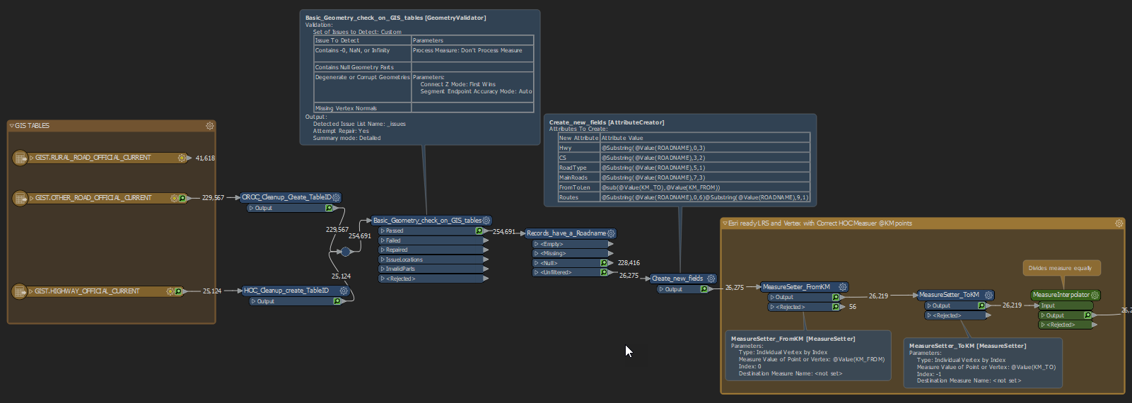
Picture 1 GIS_HIS (Highway Inventory System)

  1. take the 3 tables from oracle GIS center line WHERE ROADNAME <> Null
  2. Attach m value using the From and To fields Using this answer

image.pngadd fields, check GPS length vs (To-From length)

image.pngPicture 2 GIS_VertexPoint (ugly work space alert)
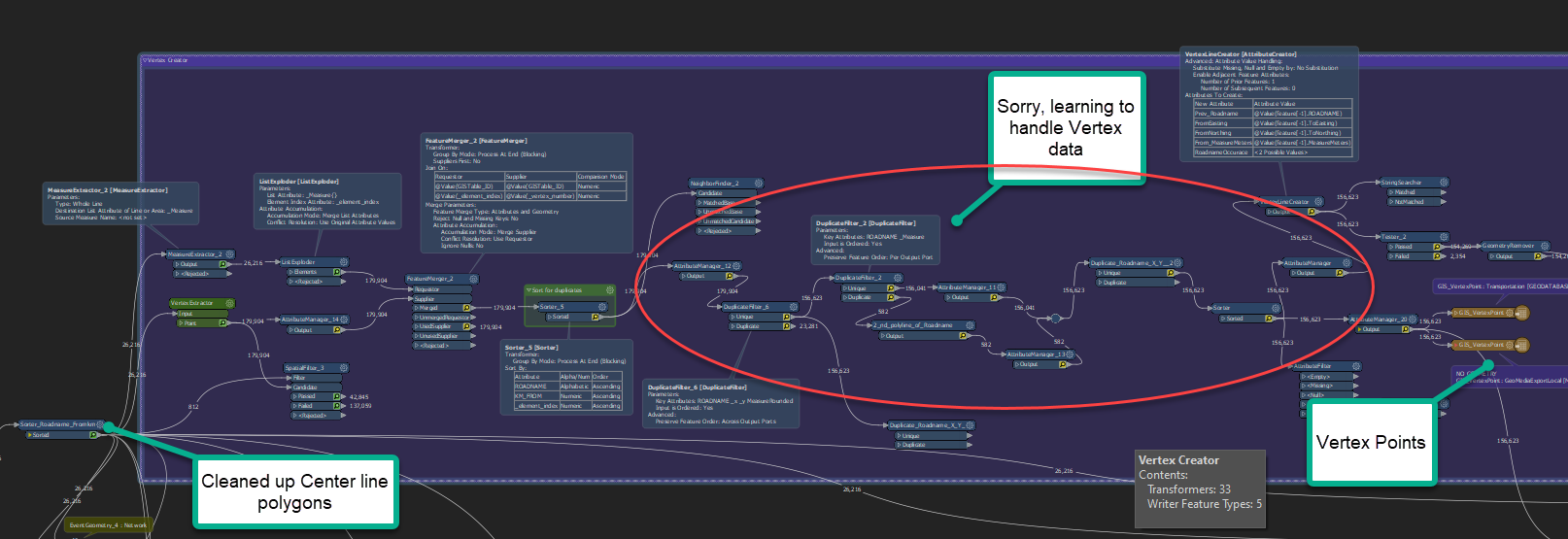
  1. Extract Vertex because they have duplicates and multipart polygons
  2. Explode the Measure list and attach for a clean Vertex layer

image.png 

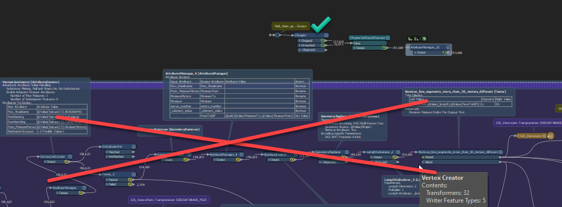
Picture 3 and 4 GIS_VertexLine

  1. Create polyline between each vertex when Prev_Roadname = Roadname
  2. Currently Filter for ToKM-FromKmLeng > 30 meters of Shape Length
    1. this has encountered a host of issues with my smaller park roads.

image.pngSamples of these multipart polylines, this is one road with From/To measures all over the place.
Maybe there are better work flows, if anyone made it this far can offer me? I'm going to read about Chopper right now.

When this is completed I will use FME to map the rest of my Ministry data. Dyn Seg data like Road Assets, projects, pilots, etc. I can stop using Geomedia as it takes a day to do what FME can do in 3 or 4 minutes.


I'd attach my work space, but I've been developing for a while to get it working. I hope to clean this up later once I get it figured out.


how many transformers is too much? I remember being told no more than 10 at the 2018 world tour!!! LOL currently at 122.

image.png 


Hi @trevorm, have you try to buffer the points by 0.1 or 0.2?

@connecter​ , I hooked up a Buffer and it would take hours to run it on my lines but thank you so much for the suggestion. I will use this transformer in 2 other work spaces though. Thank you.


I don't think I quite understand what you're trying to do here. It sounds to me like you want to use the chopper here instead jn your lines. The chopper should be able to split up your lines into segments with a max of two verticies.

You can also try and use a GeomeryPartExtractor or Deaggregator ​if you just want pure lines.​

Chopper OMG:

So I have to test still, but Chopper is amazing and just add GetRouteMeasure and attribute manager to recreate my FromKM and TOKm.. saves all this work.

Chopper vs manually creating layers


Chopper OMG:

So I have to test still, but Chopper is amazing and just add GetRouteMeasure and attribute manager to recreate my FromKM and TOKm.. saves all this work.

Chopper vs manually creating layers

Great! Yeah the chopper is a very handy tool as is the GeometryPartExtractor. Don't forget the deaggregator for splitting up multi features - this can be very helpful when trying to clean data.

You can also use an AggregateFilter to identify multi-features. A GeometryFilter is also helpful to.

Another tool which can be helpful in identifying problem geometries is the GeometryValidator.


If you have arcs in your data you can look at the ArcStroker which can turn your arc into normal lines. Arc can trip people up sometimes.


Chopper OMG:

So I have to test still, but Chopper is amazing and just add GetRouteMeasure and attribute manager to recreate my FromKM and TOKm.. saves all this work.

Chopper vs manually creating layers

Deaggregator, GeometryPartExtractor and even the AggregateFilter I wish had more details how to use it.. what to expect. I love the documentation that shows what goes in, what comes out with what settings.. Deaggregator for example gives me the same 26,000 records each time...no matter what settings i put?


Reply