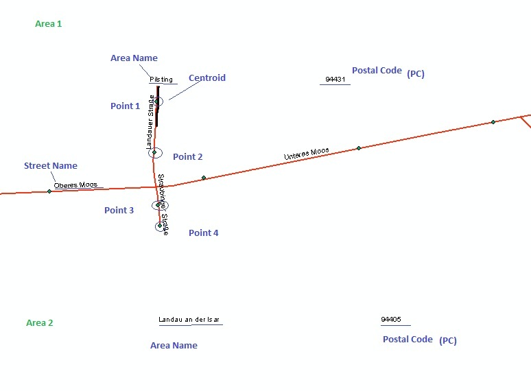
I am working on Windows 7 (64- Bit). I have two Areas, Area 1 and Area 2 (State 1 and State 2). There is a road crossing through the boundary of the State i.e., horizontal line. So, horizantal line is both, the boundary of the state and the road. Both areas (states), have there specific Postal codes (PC). So, the problem is-
At times (not always), Area 1 shows the Postal Code of Area 2 or/and vice-versa. (Vertical Line and Horizontal line). Basically, it depends on the start point. The road fetches postal codes and state names automatically from the area from where the digitization was started, disregarding of the location of the state.
For its solution i created the centroid of the road network segments, but it is creating points outside the road network.
Any other solutions for this in FME.


