Solved

Problem with write PDF 2D


danilo_fme
Evangelist
Forum|alt.badge.img+45

Hello,

I have 4 feature types and i use the transformer PDFPageFormatter to configurate my PDF output.

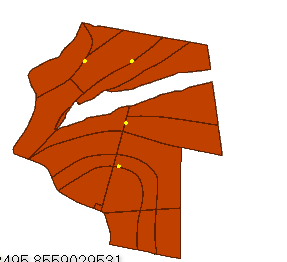
The problem is when write this Output ( attached ) the feature types didnt write exactly like FME DAta Inspector. How can i do this configurated well?

The output wrong in PDF:

Attached my template file.

Thanks

Best answer by redgeographics

The PDFPageFormatter will fill the paperspace with the data you put in it. So data with smaller extents will get more zoomed in. You should put everything into one PDFPageFormatter input, that way they will be (if they're in the same coordsys) overlayed properly. Controlling the order of the objects can be done by sorting on an attribute.

To me this is logical behaviour, every paper space is a "map" by itself (the software I use for my map production has a similar concept)

View original
Did this help you find an answer to your question?

5 replies

pratap
Contributor
Forum|alt.badge.img+11
  • Contributor
  • December 6, 2016

Hi,

Do you want as Layer in PDF? If yes have you tried fanout?

Pratap


danilo_fme
Evangelist
Forum|alt.badge.img+45
  • Author
  • Evangelist
  • December 6, 2016
pratap wrote:

Hi,

Do you want as Layer in PDF? If yes have you tried fanout?

Pratap

Hello @pratap, i just want to write pdf correct like the screen


I believe is the error is inside the transformer PDFPageFormatter.


Thanks


pratap
Contributor
Forum|alt.badge.img+11
  • Contributor
  • December 6, 2016

Due to version conflict, I cannot open your workspace. Just remove the PDFPageFormatter and try migrating directly to pdf. If it goes fine then the problem is related to PDFPageFormatter.


gio
Contributor
Forum|alt.badge.img+15
  • Contributor
  • December 6, 2016

@danilo_inovacao

Yoo have to align the geo- extents of the objects in the pdf.

You could grab the boundingbox for that. Boudingboxaccumulator for example.

There are a couple of examples on this issue n this forum.

(I should know, because I complained about this lack of auto-alignement..;))

It is indeed a manco of the pdf_pageformatter, you can't just drag in some paperspaces. They must align and have same aspectratio in the pdf. ( see readers and writers on pdf.: pageframe and worldframe) Fme 2016 still has this issue...

couple of days ago I made a post on getting foto's align with a border in pdf pages , look it up. Basically same issue


redgeographics
Celebrity
Forum|alt.badge.img+49
  • Celebrity
  • Best Answer
  • December 7, 2016

The PDFPageFormatter will fill the paperspace with the data you put in it. So data with smaller extents will get more zoomed in. You should put everything into one PDFPageFormatter input, that way they will be (if they're in the same coordsys) overlayed properly. Controlling the order of the objects can be done by sorting on an attribute.

To me this is logical behaviour, every paper space is a "map" by itself (the software I use for my map production has a similar concept)


Cookie policy

We use cookies to enhance and personalize your experience. If you accept you agree to our full cookie policy. Learn more about our cookies.

 
Cookie settings