Hello,
I am a GIS Database Analyst at the Province of Nova Scotia’s Nova Scotia Geomatics Centre working along side John Power. We have recently encountered a possible issue with FME in a workbench we have created that reads in CARIS files and coverts them to ESRI file format data where topological errors sometimes appear to be occurring during the conversion. We are trying to create a process that converts our Nova Scotia property records database’s management units (MU’s) from CARIS to ESRI format filetypes and also build polygons from the existing linework.
Our FME Version being used is FME Desktop 2022.2, I have also attached a copy of our current workbench and one of our zipped CARIS MU Units as an example.
The issue we appear to be encountering is that our FME converted lines sometimes appear to have an extra vertex added that is causing topology errors that don’t allow certain polygons to be successfully built.
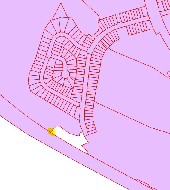
The example I’m sharing a screenshot below of MU0807 PID 41511155 in the lower left corner of this parcel, our property lines derived from FME appear to intersect on themselves, causing this polygon not to build in this case.
Overview of this particular area showing lines and polygons derived from FME Software. Highlighted yellow area contains the area the topology error is appearing.

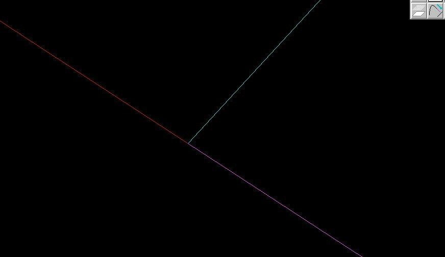
Close up of the highlighted yellow area, lower left hand corner of this parcel – FME derived lines showing the lines self intersecting on themselves
It appears FME is adding an extra vertex as the 2nd to last vertex which is overshooting the line its supposed to be snapping to?

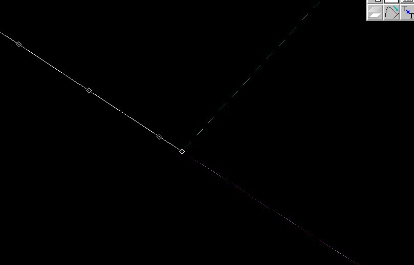
Here is the original CARIS file being viewed from CARIS showing a topologically clean intersection, Also noted when viewing this same intersection from the CARIS files using the FME inspector, it appears to have the same topological error that appears in our File Geodatabase outputted in FME.

 Any assistance you could provide to resolve this issue would be appreciated.
Cheers,
Chris Novak


