Hello,


Following this example as a starting point:


https://community.safe.com/s/article/how-to-read-all-feature-classes-from-multiple-esri


I am able to convert all of the feature classes in a file GeoDatabase to shapefiles. In production, the workflow would actually import the feature classes into an Enterprise GeoDatabase, while reprojecting the geometry as well.


After making the modification to the above example so that the output is directed to our EGDB and then running the workspace, the log indicates a successful connection, however it subsequently fails with a very unhelpful message, "Error running translation".
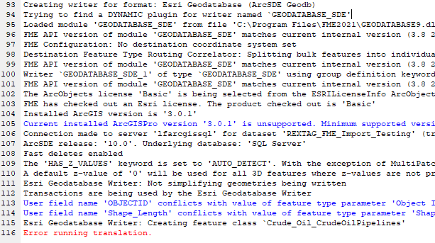
Log ClipBelow is a screenshot of the workflow, modified to test for particular feature classes (as well as a disconnected reprojection step, as I'm not sure if simply placing it between the FeatureReader and Dynamic Writer would work, considering the dynamic nature of the workflow that would input to sources to the reprojector).

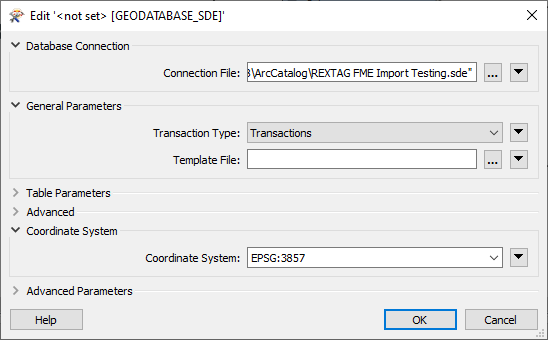
WorkflowAnd the EGDB writer properties and parameters:
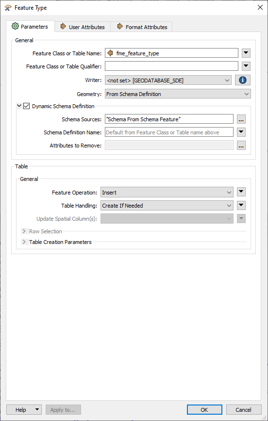
PropertiesParameters 

 Also, if I wanted to connect the reprojector, where would that go? Between the Feature Reader and the Writer, using both the Schema and Generic ports from the Reader as inputs? My hunch is that is wrong and an intermediate step would be required.

@lancec​ The message 'error running translation' generally means FME has crashed.

You could try adding a Decelerator transformer with Delay = 0. If this does not help, you should probably log a support case with Safe or your FME provider. Please include:

  • reference to this question
  • version of FME
  • full FME log file
  • Workspace and if possible a FME Workspace Template (.fmwt) that include a copy of the workspace plus source data)

OK, it turns out it was an ArcGIS license level issue. But I didn't know this because the installed version of FME at the time I authored the workspace in gave such an ambiguous error message, as detailed above. Once I upgraded to v2022, the error message was more detailed and indicated that inserting, creating, etc. were not possible with the Basic level ArcGIS License. Once I changed it to Advanced, it worked.


However, now in ArcGIS I can see the results in the output Enterprise Geodatabase are not structured like the input File Geodatabase. The input has several Feature Datasets with each containing Feature Classes. The output geodatabase does not contain the Feature Datasets. Instead, it just inserts all the Feature Classes at the root level, with names like <FeatureDatasetName>_<FeatureClassName>. How can I get the translation to respect the Feature Datasets?


Attached is the workspace. I cannot include the input data.


Nevermind...using the ESRI SDE GeoDatabase readers and writers instead of the Open API version fixe that.


Reply