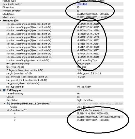
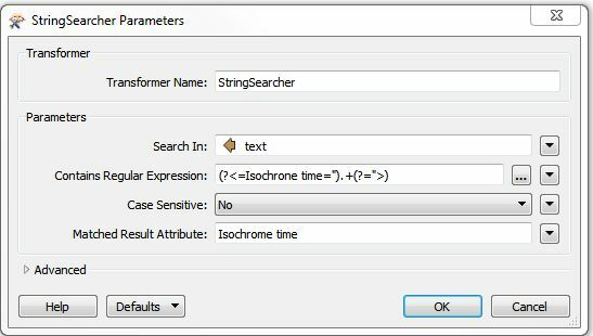
Hi I am trying to sent some dat to an api and retrieved some polygons which are being returned back using the http caller but not sure how to get the the output to mapinfo as polygons? Below is an example of the output when I save to file (formatting might have changed slightly when I pasted into this question box) but really want to go via attribute option of the HTTP Caller?
<?xml version="1.0" encoding="UTF-8"?>
-<aas:AAS xsi:schemaLocation="http://www.geoinform.fh-mainz.de/aas D:/Schemata/AAS1.0/AccessibilityService.xsd" version="1.0" xmlns:gml="http://www.opengis.net/gml" xmlns:xsi="http://www.w3.org/2001/XMLSchema-instance" xmlns:aas="http://www.geoinform.fh-mainz.de/aas">
<aas:ResponseHeader xsi:type="aas:ResponseHeaderType"/>
-<aas:Response version="1.0" xsi:type="aas:ResponseType" requestID="00">
-<aas:AccessibilityResponse xsi:type="aas:AccessibilityResponseType">
-<aas:AccessibilitySummary>
<aas:NumberOfLocations>0</aas:NumberOfLocations>
-<aas:BoundingBox srsName="EPSG:4326">
<gml:pos>-1.6862003 53.6159234</gml:pos>
<gml:pos>-1.6818549 53.6203252</gml:pos>
</aas:BoundingBox>
</aas:AccessibilitySummary>
-<aas:AccessibilityGeometry>
-<aas:Isochrone time="60.0">
-<aas:IsochroneGeometry area="304297.36">
-<gml:Polygon srsName="EPSG:4326">
-<gml:exterior>
-<gml:LinearRing xsi:type="gml:LinearRingType">
<gml:pos>-1.6841016 53.6164491</gml:pos>
<gml:pos>-1.6835025 53.6162827</gml:pos>
<gml:pos>-1.6823042 53.6159234</gml:pos>
<gml:pos>-1.6818549 53.6162827</gml:pos>
<gml:pos>-1.6818549 53.6180794</gml:pos>
<gml:pos>-1.6818549 53.6198760</gml:pos>
<gml:pos>-1.6823042 53.6203252</gml:pos>
<gml:pos>-1.6841016 53.6203252</gml:pos>
<gml:pos>-1.6848628 53.6198760</gml:pos>
<gml:pos>-1.6858991 53.6185285</gml:pos>
<gml:pos>-1.6862003 53.6180794</gml:pos>
<gml:pos>-1.6858991 53.6169952</gml:pos>
<gml:pos>-1.6841016 53.6164491</gml:pos>
</gml:LinearRing>
</gml:exterior>
</gml:Polygon>
</aas:IsochroneGeometry>
</aas:Isochrone>
</aas:AccessibilityGeometry>
</aas:AccessibilityResponse>
</aas:Response>
</aas:AAS>
Thanks
Neil


