I wish to replicate the following workflow from ArcMap

1. delete unnecessary fields from dataset table

2. add in new fields and put a default value of "no"

3. Using select by location, filter data that overlaps with another dataset and the field calculate the overlapping polygons with "yes"

I need to do this for 40+ intersecting datasets and am new to FME. I have steps 1 and 2 complete but step 3 has me stumped. I've tried SpatialRelator, Spatial Filter, AreaOnAreaOverlay with no luck.

You should be able to use a spatial relator alongside an attributecreator to achieve this.

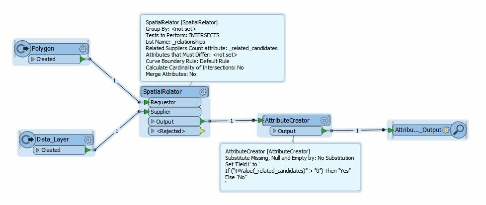
The polygon layer connects to the requestor port with the data layer connecting to the supplier, then an attribuecreator with a conditional value if _related_candidates > 0 then Field value = "Yes" else "No"


You should be able to use a spatial relator alongside an attributecreator to achieve this.

The polygon layer connects to the requestor port with the data layer connecting to the supplier, then an attribuecreator with a conditional value if _related_candidates > 0 then Field value = "Yes" else "No"

thank you, worked great


Reply