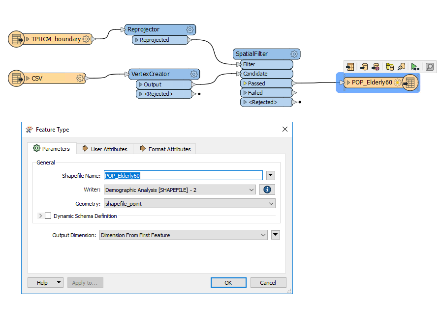
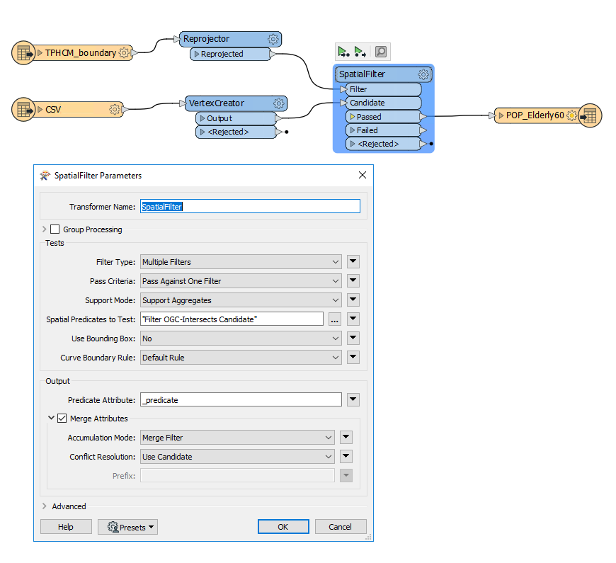
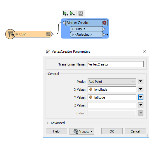
I have a CSV file with Longtitude and Latitude fields (more than 10.000 records) and I want to convert these to point (shapefile). After that I want continue use a polygon to select which points intersect with it? I tried to use VertexCreator and SpatialFilter or PointOnAreaOverlayer but it didn't work like my expect. So who can help me to solve this problem. Thank you so much! 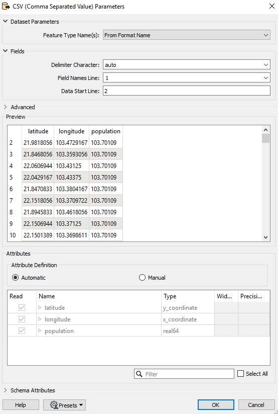

Question
How to convert CSV (Longtitude & Latitude) to point (shapefile) and after that filter by polygon to select and export point which intersect with polygon?


Reply
Rich Text Editor, editor1
Editor toolbars
Press ALT 0 for help
Helpful Members This Week


Enter your E-mail address. We'll send you an e-mail with instructions to reset your password.