Question

How to convert CSV (Longtitude & Latitude) to point (shapefile) and after that filter by polygon to select and export point which intersect with polygon?


khaphan

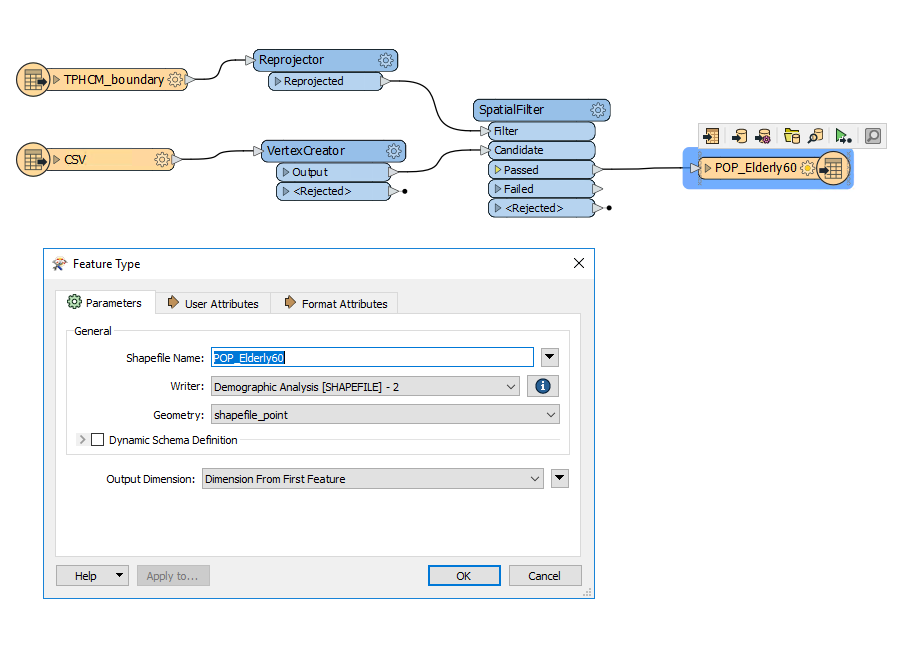
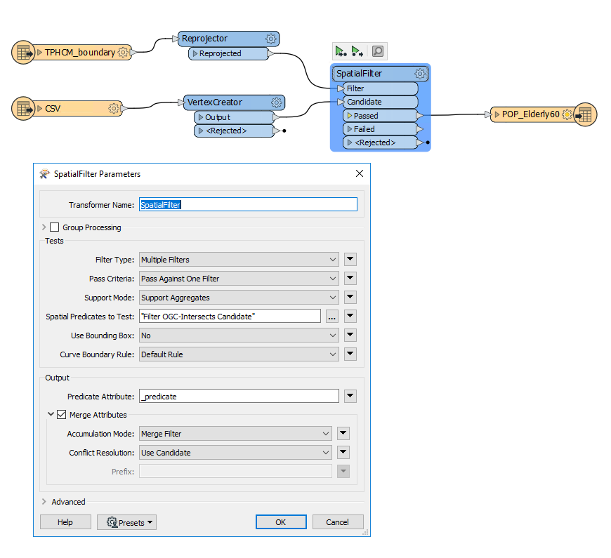
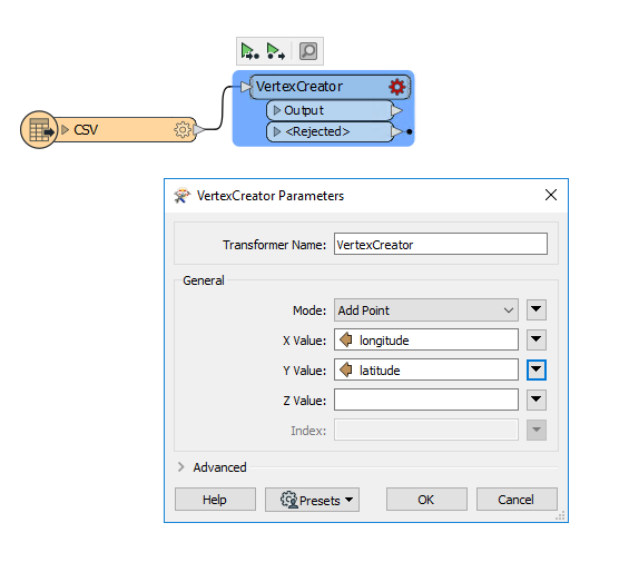
I have a CSV file with Longtitude and Latitude fields (more than 10.000 records) and I want to convert these to point (shapefile). After that I want continue use a polygon to select which points intersect with it? I tried to use VertexCreator and SpatialFilter or PointOnAreaOverlayer but it didn't work like my expect. So who can help me to solve this problem. Thank you so much!
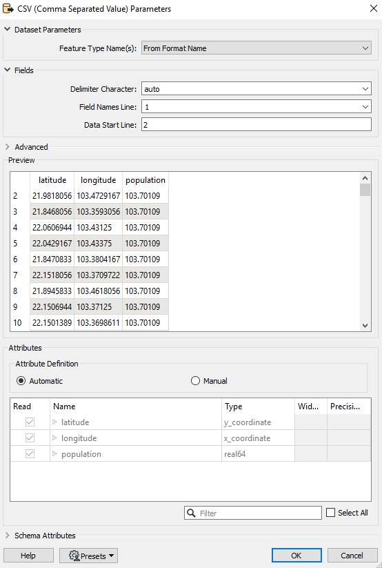
 CSV2PointCSV2Point_3CSV2Point_2CSV2Point_1

3 replies

jkr_wrk
Influencer
Forum|alt.badge.img+29
  • July 24, 2021

If you connect an inspector to the Reprojector and one to the VertexCreator. Do both geometries show up on the same location?


khaphan
  • Author
  • July 24, 2021
jkr_da wrote:

If you connect an inspector to the Reprojector and one to the VertexCreator. Do both geometries show up on the same location?

Yes, cause CSV has longitude and Latitude that coordinate System is LL84. So I have to reprojector Polygon to same LL84 project.


khaphan
  • Author
  • July 24, 2021
jkr_da wrote:

If you connect an inspector to the Reprojector and one to the VertexCreator. Do both geometries show up on the same location?

After SpatialFilter step, the data be written to POP_Elderly60.shp but it have error "SHAPEFILE writer: Failed to delete the following files: 'mapping_log.ffs'. Please ensure that the files are not in use and that you have sufficient privileges to delete them.".


Cookie policy

We use cookies to enhance and personalize your experience. If you accept you agree to our full cookie policy. Learn more about our cookies.

 
Cookie settings