

Good day!
I've a task with spatial adjustment of vector data (like in ArcGIS).
My spatial grid presented in unknown coordinate system. But it looks like World Mercator.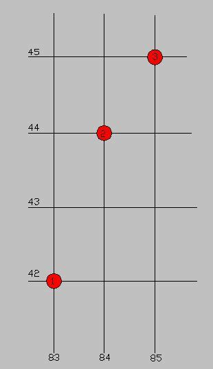
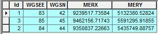
I know where nodes from this grid should be placed (see table)
I found that shift parameters which i calculated don't compare, because grid coordinates along north directions has scale factor. It would be good if somebody will help me to understand how i can transform this grid to Mercator.

